Australia So Much to See
Copyright (C) 2013 AustraliaSoMuchtoSee.com. All reights reserved
Home > Where did we go and what did we see in 2017?
While we are on tour, Australia So Much to See will have only minimal updating. New travelogues and new articles will be added
after we return home. Watch for posts of where we are as we tour this great country of Australia.
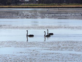
Gum Bend Lake campsite at Condobolin, with facilities including hot showers, all for a donation. This large manmade lake is rich with birdlife. A lovely place to spend a few days.
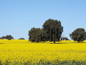
The area south of Condobolin had the best crops we have seen so far in this dry inland. The gold of Canola dominated.
In 1938, John Gibson, a gold miner and prospector at nearby Weethalle, arrived at Kikoira in search of more gold. Instead of gold, Gibson found a rich tin deposit. Gibson developed a mine and by October that year, the mine was employing 21 workers. A In 1938, John Gibson, a gold miner and prospector at nearby Weethalle, arrived at Kikoira in search of more gold. Instead of gold, Gibson found a rich tin deposit. Gibson quickly developed a mine and by October that year, the mine was employing 21 workers. A large area around Kikoira pegged for mining claims by March 1939.
The mine continued to grow and in 1940 it was producing more tin than any field in Australia outside of Tasmania.
Mining continued into the 1960s and 1970s. An alluvual tin treatment plant was built at Gibsonvale in 1968. The plant was designed to produce 36 tonnes of tin concentrate per month.
The mine continued to grow and in 1940 it was producing more tin than any field in Australia outside of Tasmania.
Mining continued into the 1960s and 1970s. An alluvual tin treatment plant was built at Gibsonvale in 1968. The plant was designed to produce 36 tonnes of tin concentrate per month.
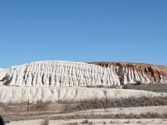
Heading further south we found this white and pink slag heaps of soft clay had eroded with natural beauty. Former open cuts water. Many of these old mine sights can be seen around Kikoira and Gibsonvale.
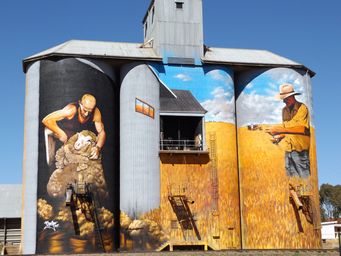
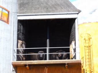
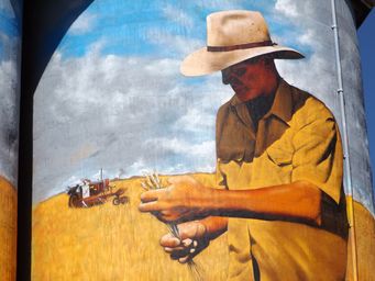
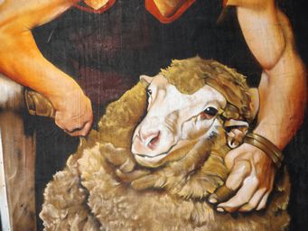
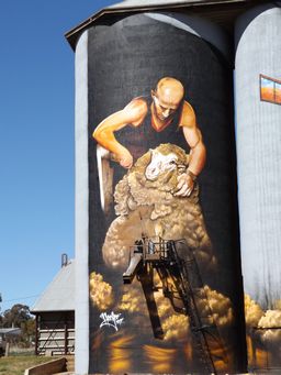
Soon we reached our destination, the tiny town of Weethalle, where a street of long closed shops told a story of a past. The Hotel remains open, and a cafe called "Road Kill Grillz" was further on past the old shops. But visitors were coming and stopping for another reason. Opened 1st July this year, New South Wales first painted silos were a magnificent work of art.
Ladders and shutes were painted to blend in with the rural scenes, and use was made of a ledge to create a shearing shed with sheep in pens.
Ladders and shutes were painted to blend in with the rural scenes, and use was made of a ledge to create a shearing shed with sheep in pens.
This really is silo art at its finest.
Visit Weethalle, 58 kilometres west of West Wyalong via the Mid Western Highway.
Campers and caravanners are welcome to stay at the Weethalle showground for $10 per night, with power, amenities and water.
Visit Weethalle, 58 kilometres west of West Wyalong via the Mid Western Highway.
Campers and caravanners are welcome to stay at the Weethalle showground for $10 per night, with power, amenities and water.
What have we seen over the past week or two? We have seen lots and covered some distance. Here is a few photos.
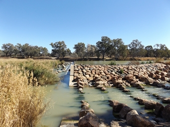
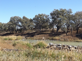
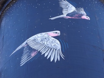
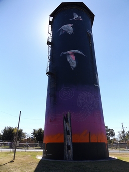
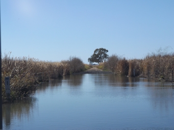
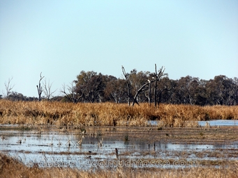
Not expecting to see any of the Macquarie Marshes as the nature reserves are not open to the public and it has been a dry year, we were surprised and delighted to find ourselves between paddocks with large tracts of water. Water was flowing across the road at one point, up to about 700 millimetres deep.
At Coonamble a water tank has been painted by artist John Murray, with Aboriginal design by Sooty Welsh, and aided by Bob Bennett. Completed 1st July this year, it is drawing visitors to Coonamble.
At Brewarrina, the stones in the river that comprise ancient Aboriginal fish traps were partially covers due to water being released over the adjacent weir. These traps have been dated at over 40,000 years old, and are considered possibly to oldest man made device on Earth, showing Australian Aboriginal culture as possibly the oldest. Finds at Mungo also support this theory.
To allow fish to swim up and down the river, alongside the weir at Brewarrina a very simple fish ladder has been created from stones.
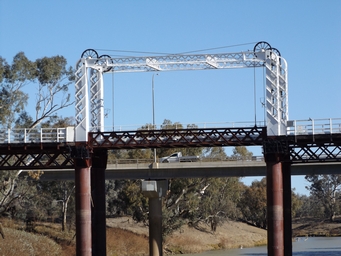
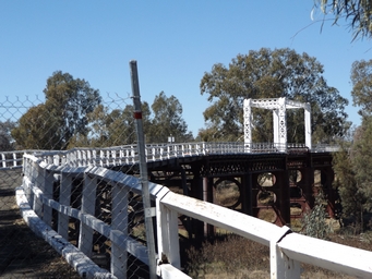
At North Bourke, the old lift bridge which used to allow barges to pass under it still stands alongside the present traffic bridge. A counter balancing system allowed on person to lift the centre span when needed for barges to travel under the bridge. When road and rail transport took over, the last commercial barge on the Darling River was in 1931.
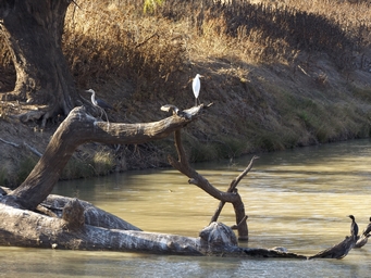
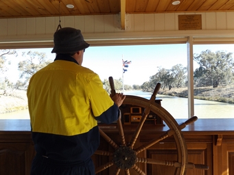
The modern replica of the former PS Jandra takes tourists on an one hour cruise on the Darling River, upstream of the Bourke Weir. Numerous birds were spotted during this short cruise.
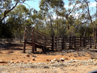
Touring the Gundabooka national parks and conservation areas we saw remains of station buildings and facilities. Four stations were taken over to create these parks. Above left are old cattle yards.
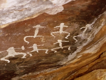
At Mulgowan (Yappa) Aboriginal rock painting site (above right), paintings were done mainly in white. Stencil hands in red and white were also in this cave.
At Mulgowan (Yappa) Aboriginal rock painting site (above right), paintings were done mainly in white. Stencil hands in red and white were also in this cave.
The tiny river town of Louth was once a busy river port. Above right is the Darling River from the Louth Bridge. At left is the historic hotel.