Australia So Much to See


Copyright (C) 2013 AustraliaSoMuchtoSee.com. All reights reserved
< Previous
Home
Travelogues
Tips and Hints
Lists and Links
Q & A
Contact
< Previous
Home
Travelogues
Tips and Hints
Lists and Links
Q & A
Contact
Home > Travelogues > 2021 Travelogues Index > Wheatbelt Western Australia > Bodallin to Moorine Rock
 

Moorine Rock is located on the Great Eastern Highway and the railway line from Northam to Southern Cross. When the rail line was opened in 1895 a railway station was established here and named Parkers Road after a nearby road. The road led to Parker Range an area where Mr W M Parker made a gold find in 1888. In 1923 the district surveyor for the area reported there was a need to survey some lots at Parkers Road station. The survey was carried out the following year and in 1925 the area was gazetted as the townsite of Parker Road.


In 1926 the local member of Parliament advised the name of the townsite was causing confusion because it was too similar to Parker Range a nearby goldmining area and was also the name of a road in Southern Cross. He suggested the alternative name of Moorine after Moorine Rock. This name was too similar to Moora but was accepted with the full name Moorine Rock. The change of name of the townsite was gazetted in 1926. Moorine Rock is the Aboriginal name of some rocks around eight kilometres from the townsite, first recorded by an explorer in 1865. The meaning of the name is not known.


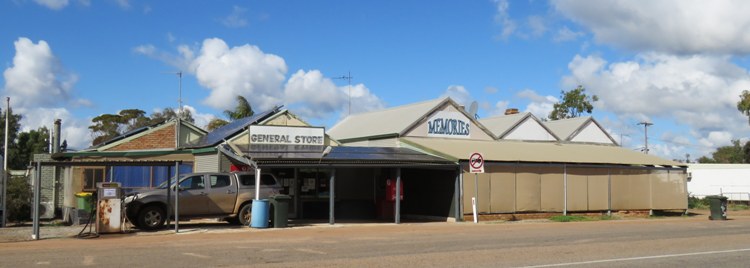
There is little here now; a small primary school, a faded small store, postal agency and fuel outlet, and a lovely hotel in a building dating to 1931.  The CBH grain receivals bin is by the railway line five kilometres west of the town.  There is a parking area with toilets near the hotel, but overnight stays are not permitted. There is a tennis club with tennis courts and an oval which appears little used.    
Moorine Rock

Bodallin References

Visit Yilgarn 

Golden Pipeline

WA Now and Then

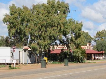
Moorine Rock Hotel.  This lovely building was opened here in 1931.  This historical Hotel was moved twice. It was first in Marvel Loch, then moved to Burbidge in 1923, then later moved to Moorine Rock.

Bodallin is thought to mean Big Round Rock, and like most Aboriginal place names it has had several different spellings. 


This tiny town has a roadhouse which has a small shop and is a post office agency, a few houses, and the old school building. The school was opened in 1924 and closed in 2002.  It is now used for seasonal worker accommodation. 

Bodallin has been a stop on the railway line since 1894 and still is.  The is a CBH grain receivals bin by the railway line.


Bodallin grew near where one of the railway dams was built to supply water for steam engines.


Camping is offered at the highway-side rest area, with a toilet block and playground.  This is near the roadhouse.  For a quieter night camping by the old railway dam near a low granite outcrop is an alternative.  Turn south on Stephen Road about five kilometres west of Bodallin, with the track into the dam around one kilometre from the highway.  Tight turnaround so for larger rigs walk in and check first.  There is a very old stone bakers’ oven in the vicinity of the dam. 

The small store, postal agency and fuel outlet on the Great Eastern Highway at Moorine Rock above. 

Bodallin

Moorine Rock References
Outback Family History
Tourism Shire if Yilgarn
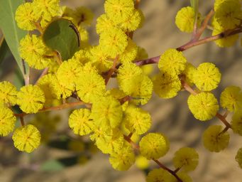
With many different Acacia (Wattle) species in the area, above left is the prolific flowering Acacia densiflora.

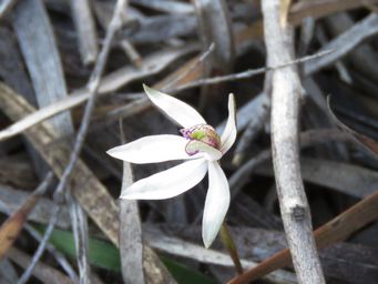
Above right is a lovely tiny Ericksonella saccharata, Sugar orchid. 
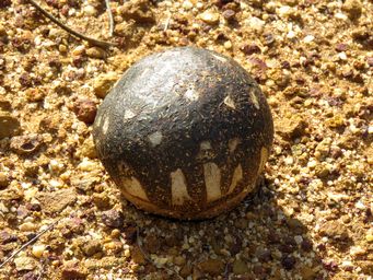
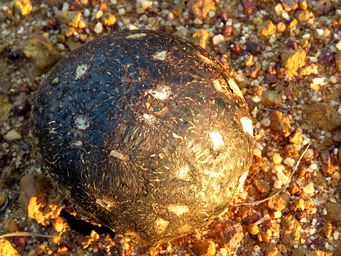
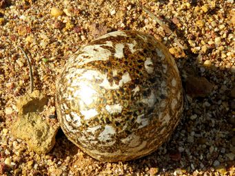
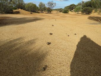
Puffball fungi were as big as tennis balls, and often appeared in lines.  Each one had a different pattern.  These can push through very hard and stony ground, even through bitumised surfaces. 
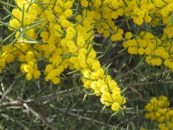
Acacia steedmanii subsp steedmanii had sprays of golden blooms at the end to the branches on a medium height shrub.    
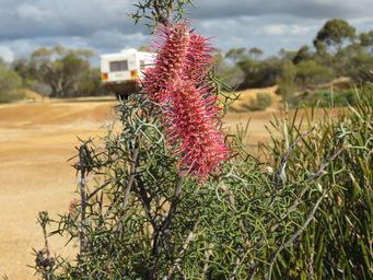
We found a disused gravel pit in bushland with so many vibrant wildflowers a few kilometres from the townsite.  Grevillea paradoxa at right. 
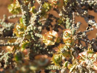
Above left is Maireana glomerifolia, Ball Leaf Bluebush.  These are a group of over thirty different species of small bushes that grow throughout the central and semi arid areas of Western Australia, and many are known as Bluebush due to the bluish tinge to the foliage.  Flowers are small and rarely noticed, after which a circular wing develops, which can be colourful, semi-translucent or hairy. 

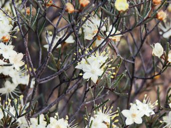
To the right is Phebalium filifolium, Slender Phebalium.  Phebalium are a mostly cream or white flowering genus of flowers with long stamens.  Foliage is usually bumpy or 'warty'.  Filifolium mean fine leaves. 
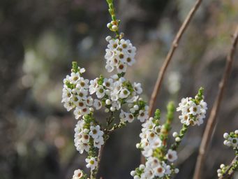
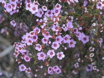
There were many shrubs covered with small flowers such as these; above left is Euryomyrtus maidenii and above right the tiny flowering Micromyrtus racemosa.
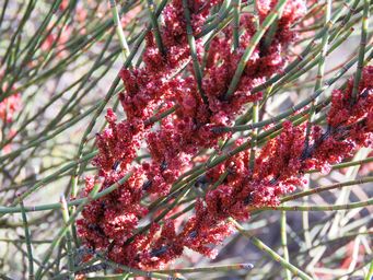
Taller shrubs included Allocasuarina spinosissima, one of several Allocasuarina species in the area.  These are the flowers of a female shrub. 

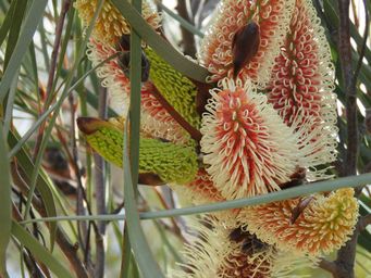
Above right is Hakea francisiana, one of many Hakea species we saw.  Pink Pokers is one of a number of different common names for this species, seen here with some blooms still opening.   
Follow our wheatbelt and goldfields touring on the following pages
wildflower_nav_buttons.jpg
Want to know more?
Contact Us
Back to Top ^
750_banner_moorine_rock_img_0027sc.jpg 341_moorine_rock_img_0028.jpg 341_puffball_fungus_img_9988c.jpg 341_puffball_fungus_img_9926.jpg 341_puffball_fungus_img_9985c.jpg 341_puffball_fungus_img_9900.jpg 341_phebalium_filifolium_img_9885a.jpg 341_micromyrtus_racemosa_img_9965.jpg 341_maireana_glomerifolia_img_0532.jpg 341_grevillea_paradoxa_img_9890.jpg 341_hakea_francisiana_img_9892.jpg 341_euryomyrtus_maidenii_maybe_mr_img_9845c.jpg 341_allocasuarina_spinosissima_img_9873a.jpg 341_ericksonella_saccharata_img_9921ca.jpg 341_acacia_mr_img_9880.jpg 341_acacia_maybe_densiflora_mr_img_9895.jpg
Next >
Next >
Continue reading >
See more Wildflowers of Western Australia on our Wildflower section