Australia So Much to See


Want to know more? Ask us
< Previous
travasmtc2009b014001.gif
Next page >
Home
Travelogues
Tips and Hints
Lists and Links
Q & A
Contact
< Previous
travasmtc2009b014001.gif
Next page >
Home
Travelogues
Tips and Hints
Lists and Links
Q & A
Contact
Home > Travelogues > 2009 Travelogues Index > Hughenden > Porcupine Gorge

Hughenden - we start with a visit to Porcupine Gorge

A short trip to Porcupine Gorge


Porcupine Gorge

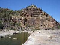
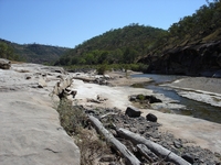
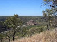
The first lookout in the National Park is sixty kilometres from Hughenden, with the Pyramid being a further eleven kilometres. A walk can be taken down into the gorge and along flattish white rock to the Pyramid.  There are 964 steps cut into the rock on the way down to the valley floor.  


In this wider section of the gorge the eroding action of the creek has also created the pyramid shaped monolith of multi-coloured sandstone rising from the floor of the gorge.  The creek forms a pool as it turns across the base of the pyramid. 
 

Geology of Porcupine Gorge

Continue reading >

Back to top ^

Before we tour the town of Hughenden and head to Muttaburra on the following pages, we go north Porcupine Gorge
 
tn_cattlematchboxcrkjpg.jpg tn_whistlingbore.jpg tn_porcupinenetteddragon.jpg tn_porcupine8.jpg tn_porcupine7s.jpg tn_porcupine6.jpg tn_porcupine5.jpg tn_porcupine4.jpg tn_porcupine3.jpg tn_porcupine2.jpg tn_porcupine1.jpg tn_eaglehawkgorge.jpg

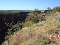
At Eagle Hawk Gorge lookout, the southern start of the Porcupine Creek gorge can be seen.  The gorge runs for 100 kilometres northwards from here. 


Taking a deviation from fossil viewing, we go north on the Kennedy Developmental Road to Porcupine Gorge National Park.  It is an easy day trip from Hughenden, or there is a small National Parks campground on site at the Pyramid.  Being uncertain of the size and access of sites at the park, we stopped overnight along the way.   The road varied between gravel and smooth clay with some patches bitumenised.


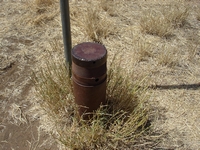
There are a number of signed points of interest along the road from Hughenden.  These include Whistling Bore, where a capped bore can be heard humming or whistling as air rushes out according to atmospheric pressure.  It was put down to provide water for a stock route.  There is now a large dam with windmill nearby. 


Whistling Bore


Depending on atmospheric pressure, a distinct whistle can be heard through the hole in the cap sealing the bore. The bore was originally put down as a stock route watering facility but abandoned when at 500 feet deep water still did not rise. On most days, a humming sound can be heard.


Why it whistles is a mystery, but one reason offered is a cave-in somewhere in the shaft of the bore has created a wind tunnel.


Eagle Hawk Gorge


Porcupine Gorge begins at this scenic lookout and extends at least another 100 kilometres north.  Two scenic lookouts are located further north within the National Park boundaries. 


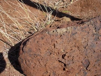
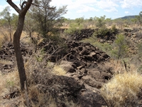
You will note the basalt formations are abundant here, attributed to Mount Desolation, an extinct volcano located nearby.  This basalt tableland has both red and black volcanic soils.  The black soil caries Flinders bull Mitchell, ordinary Mitchell and blue grasses, while the red volcanic country supports black spear, feather top, kangaroo and tableland Mitchell grasses.  Timbers of the red soil country are predominantly iron bark and bloodwood, while gidgee and boree are prevalent on the black basalt country. 


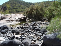
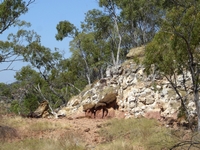
Covering an area of 5,410 hectares, Porcupine Gorge National Park extends for more than 25 kilometres along Porcupine Creek. The gorge takes its name from the echidnas (also called porcupines because of their spiny quills) inhabiting the surrounding scrub. The canyon has been carved by Porcupine Creek out of basalt lava capped sandstone, with soft colours of the walls towering 150 metres over the creek.   

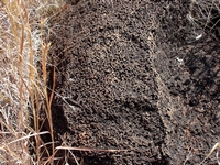
Both red and black basalt rocks can be seen at the top of the gorge. 
Copyright (C) 2013 AustraliaSoMuchtoSee.com. All rights reserved