Australia So Much to See


Want to know more? Ask us
< Previous
travasmtc2009a012002.gif
Next page >
Home
Travelogues
Tips and Hints
Lists and Links
Q & A
Contact
< Previous
travasmtc2009a012002.gif
Next page >
Home
Travelogues
Tips and Hints
Lists and Links
Q & A
Contact
Home > Travelogues > 2009 Travelogues Index > Tennant Creek to Mataranka
Continue reading >

Back to top ^

Tennant Creek to Mataranka

Three Ways is on the junction of the Stuart Highway and the Barkly Highway, which travels east and on into Queensland.  Once again just another outback roadhouse.  


travasmtc2009a012001.jpg tn_churchill.jpg tn_ntflower.jpg

Attack Creek now has a large 24 hour rest area alongside the highway by the creek where John McDouall Stuart and his party were attacked by local Aborigines whose intention was not to harm them but to scare them away from the waterhole as water is scarce in the arid area.  There is a memorial to Stuart at this site.  Were Stuart and his party actually the first Europeans to reach this arid inland region?  What had Stuart seen that made him think otherwise?

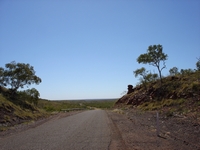
A kilometre north of Attack Creek rest area, a thirteen kilometre long stretch of the old highway has been retained in good condition and passes a rocky pillar overhanging the road and known as Churchill’s Head.  Someone has placed a stick strategically to appear like a cigar in Churchill’s mouth.  There are several places where the Highway has been re-aligned and some of these roads are accessible and others now obscure or fenced off.  Easy access ones can be suitable for stopping overnight.


A track runs along the north east side of Morphett Creek which accesses remains of WWII buildings and an unmarked grave.  Several dumps of rusting fuel drums can be seen along the highway and would date back to War times. 

Approaching Elliott, the large seasonal Lake Woods could be seen to the west.  At the northern end of this lake system there is a reserve for the permanent Longreach Waterhole which is popular for bird watching.  This also used to be a popular campsite, but camping was ceased in 2017 due to misuse.  Elliott was a staging post for the army during WWII, and numerous foundations and remnants from this era run through the entire length of this small town.  A small town remains along the Highway.  Read more about Elliott from signage at the site.

At Newcastle Waters, little remains but the pastoral station.  A roadside rest area has information boards.  This area marks the divide between the desert and spinifex scrublands to the south and the denser woodlands grass of the semi tropical areas to the north.  To the west is desert, and the black clay grasslands of the Barkly are to the east.  Read more from the signage on the Information Boards about the history of Newcastle Waters, from Desert to Tropics, and the cracking clay of the Barkly grasslands.

The change in vegetation soon became evident as we entered woodlands rather than the light scrublands we had passed further south. By the time we stopped that night, we would be in dense forest and amongst large semi tropical trees. 


'The Overland Telegraph Line. This plaque was erected in memory of Sir Charles Todd, Postmaster-General of the Province of South Australia. His gallant construction teams, operators, and linesmen.  The northern and southern parts of this epic overland telegraph line were finally joined about one mile west of this spot by R.C. Paterson, engineer, at 3.15 pm on Thursday August 22nd, 1872 thus making possible for the first time instantaneous telegraph communication between Australia and Great Britain.'


Dunmarra is another Stuart Highway roadhouse.  The story of how the locality was named is that Dan O'Mara, a linesman on the Overland Telegraph Line, went missing in the area in the early 1900s. Aboriginal trackers engaged in the search pronounced his name Dun Marra and the name stayed, at first for the pastoral station, then for the Hotel and Store that used to supply provisions to locals and travellers.


It was to the south of Dunmarra that the north and south bound teams constructing the Overland Telegraph line met, completing the link between Australia and the rest of the world. 


A four kilometre deviation from the present Stuart Highway took us to Daly Waters and the nearby the historic 1930s airfield which was Australia’s first international airport.   The Qantas hanger is intact.  It was used as a military airfield during the war years.  The runway was surprisingly short.  A flying fox, used to get supplies across the river between the airfield and the town is still intact.  A bridge now crosses the river.  Nearby is a tree blazed by Stuart during his explorations in 1862.  


Daly Waters Hotel claims to hold the Northern Territory’s longest licence, being licensed since 1938. The building itself is not the original.  This quaint and popular Pub offers camping behind the Hotel and a feed of barbecued Barra and Beef, followed by entertainment.  There used to be cheap camping and meal, but prices had risen with the times. When we arrived, the paddock behind the Hotel was overcrowded with campers and the very basic camping at no longer what I consider low cost.  With the meals now $27.50 it did not entice us in to brave the crowds swelling towards the Pub for the evening's entertainment.  

Larrimah is another small town that came about when an Army Depot and staging post was established here during WWII.  Nearby Railway Siding was known as Birdum.  Part of the Birdum airfield runway now forms a street in town.  A few kilometres south of the town on the east side of the Highway is the No 45 Hospital Site.  A short walk took us to a few concrete slabs and remnant ruins of the former buildings.  Read the story of life at the No 45 Hospital as recalled by one of the nurses


ALEXANDER FORREST REACHED THE OVERLAND TELEGRAPH LINE NEAR THIS POINT ON THE NIGHT OF AUGUST 31st 1879, AFTER HE AND HIS PARTY HAD MADE AN EPIC JOURNEY FROM DE GREY ON THE W.A. COAST.


ERECTED BY THE ROYAL W.A. HISTORICAL SOCIETY AND KATHERINE HISTORICAL, AUGUST 31st 1979.
  

Read more about Forrest's journey here
tn_wwiihospital.jpg tn_gorrierunway.jpg tn_elliotremnants.jpg tn_dalypub.jpg tn_dalylanding_lights.jpg tn_dalyairfiedl.jpg tn_cattlerace.jpg tn_gorrieturkeybush.jpg

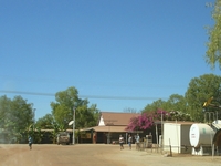
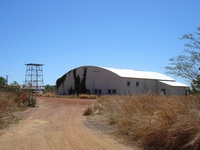
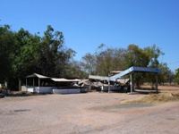
Closer to Larrimah and on the west side of the road, a track into the woodlands went to WWII relics, then onto the Birdum runway which took us back into the town and onto the Highway.  Very little remains in the town, and even the Roadhouse on the Highway had literally fallen down, with fuel no longer available at Larrimah. 

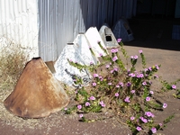
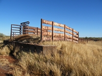
We were intrigued by the distinctive shaped second hand metal with identically placed holes in each one as used on this cattle loading race.  Fences in the area were also built using the same as posts.  We soon worked out that they were a covering used over railway sleepers.

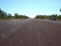
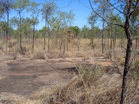
Nine kilometres to the north of Larrimah is the Gorrie Airfield turnoff.  There is a confusion of tracks heading in all directions once into the bush, with some to relic sites and others just good bush camping opportunities.  The two kilometre long Gorrie Runway is one of the best preserved of the fifteen disused WWII runways in the Northern Territory. 

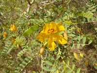
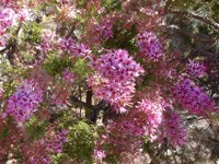
Bright pink flowering Turkey Bush shrubs were encroaching into the runway along the sides.   An army depot site was nearby. 

Crossing Warloch Ponds (Elsey Creek) the road was high above a wide green grassy floodplain.  We were reaching the land known as The Never Never; the land Jeannie Gunn wrote of in her novel which gave the name, and into the land of lush tropical vegetation, wetlands and hot springs.
tn_larrimahservo.jpg

As we travel into tropical latitudes, we enjoy hot springs and rainforests at Mataranka, and drives and walks in the Elsey National Park.

Copyright (C) 2013 AustraliaSoMuchtoSee.com. All rights reserved
A few kilometres north of this feature, and 92 kilometres south of Elliott, Renner Springs consists of a roadhouse and hotel, with caravan sites available.
See Where to camp along the Stuart Highway between Alice Springs and Darwin 
 
 
and Distances between fuel outlets on the Stuart Highway
Elliott will be the site of the largest solar power plant in the world, with much of the power produced being sold to Singapore via a 4,500 kilometre under-sea cable.   Plans were announced in 2020. Further developments on the plans for the world's largest solar farm.