Australia So Much to See


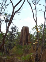
Not all the termites in Litchfield are the type that builds compass orientated mounds; so you will also see many more of the
tall red cathedral mounds similar to those throughout Kakadu and much of north of the Northern Territory.
Litchfield National Park - We see 'magnetic' termite mounds, tin mine ruins at Bamboo Creek, and walk along Walker Creek
First we had to get to Litchfield. Heading south from Darwin, we turned of the Stuart Highway towards Bachelor. This small
town was once market gardens, a WWII camp (which was bombed by the Japanese) and in the 1950s the centre of the Rum Jungle Uranium
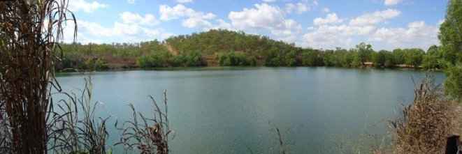
Mining industry; the first Uranium mine in Australia. We drove into the Rum Jungle picnic and boating area, where a large former open
cut mine has been filled with water to form a recreational lake.
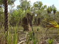
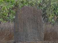
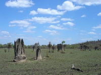
Like a graveyard of tombstones, a stand of “magnetic” termites mounds all lined up certainly give the impression of an old cemetery.
Soon after entering Litchfield National Park, we stopped at a viewing area for the well known “magnetic” termite mounds. They
are made of light grey clay and are flat on a north south axis aligned according to the Earth’s magnetic fields, to maintain the climate
at a constant temperature inside the mound. The north of Australia is the only place in the world where this phenomenon is known
to occur. There are other places in the park where stands of magnetic termite mounds can be found but this viewing area has
easy all seasons access and a boardwalk. The stands of mounds occur on floodplains which flood in the wet season and are hot
and parched in the dry. Other species of termites go underground to escape the extremes of temperature, but due to the nature
of their environment which floods in summer, they cannot retreat undergound hence use the shape and direction of the mounds to moderate
the temperature inside the mounds. Read more about "magnetic" termite mounds here
Litchfield National Park comprises 1,500 square kilometres of diverse environments including rugged sandstone landscapes, monsoon
rainforest, plains where magnetic termite mounds are found, perennial streams and waterfalls, and historic ruins from mining and pastoral
station days. With many features are accessible to all vehicles via bitumen roads, some part require a high clearance four wheel
drive and are only accessible seasonally. The National Park was declared in 1986. There are several Parks campgrounds
within the Park with only Wangi Falls designated as suitable for caravans. Generators are not permitted in the campgrounds. Pets are not permitted in the park. There are several private camping options near the park.
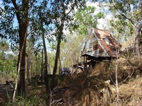
A mainly dirt road heads north from Wangi Falls and is an alternate entry into the park from the Cox Peninsula Road further north. We headed north to the former Bamboo Creek Tin Mine ruins; the access road is around seventeen kilometres north of the Wangi Falls turnoff. Mining took place here intermittently between 1906 and 1955. A one kilometre easy walk crosses the creek to the ruins of the
processing works, with a short circuit walk to remnants of old mines and other relics. Bamboo Creek Tin Mine was typical of
many of the small mines in the Northern Territory which operated in the nineteenth and early twentieth centuries, particularly those
operated by the Chinese.
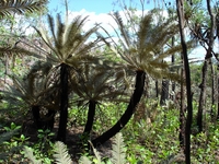
Pale leafed cycads; Cycas Calcicola
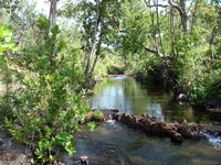
Nearby is the Walker Creek walk, with the access road being 15.5 kilometres north of the Wangi Falls turnoff. This 3.5 kilometre
two hour walk roughly follows up the creek line, past access trails to each of eight walk-in tent camp sites by pools along the creek;
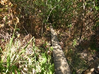
camping fees apply. After crossing the creek and a board walk continues over wetlands then the trail climbs through woodlands
and sandstone formations. The uphill walk was quite taxing in the hot weather and a cool down in the creek pools was very welcome. There is also a swimming hole at one of the picnic areas by the car park.
Planning to stay at the Wangi Falls campground, we headed through the Park via the wide bitumen road, but were disappointed to find
the crowded campground had no vacant sites to accommodate a rig our size, and most sites were not suited to larger caravans with the
dreaded bollards. Wangi Falls campground is well serviced with hot showers. This proved to be lucky, because we moved
on to the private Litchfield Safari Camp just outside of the National Park only four kilometres away and found a quiet spot in a bush
environment on the outskirts of the park. Basic amenities of hot showers and laundry were provided as well as an above ground
swimming pool. Powered sites were available with power from an on-site generator. We did not need power so were able to
move right away from the main camping area. It cost a few dollars more than the National Park campground at Wangi, but the privacy
and environment suited us better than the campground near the falls. We called at Wangi Falls on the way home from each day’s
touring to cool down with a swim.
Swim only in designated safe areas when the pools are open after the wet season and when declared crocodile safe. Florence Falls,
Buley Rockhole, Wangi Falls, Walker Creek, Cascades, Tjaynera Falls and Surprise Creek Falls are all considered safe in season; watch
for signage and do not swim if closed. Cascades is a new area between Wangi Falls and Walker Creek opened to the public in 2010,
subsequent to our visit. Do not enter the water at Reynolds River. Some areas are sacred to Aboriginals and swimming is
not permitted. Swimming is not permitted above or below Tolmer Falls, although a tour group was cooling down in the water above
the falls as this is permitted under the supervision of certain tour operators. Swimming is not permitted at Greenant Creek.
From our turn around point, the trail continues on with the 39 kilometre Tabletop loop track, with additional link walks into Walker Creek,Florence Falls, Greenant Creek and Wangi Falls. Allow three to five days for the full circuit, which is classified as moderate
to difficult. The track is normally closed between September and March for the wet season. Walkers must carry a topographical
map and the detailed topographic map of the area ‘Australia’s Northern Territory Litchfield National Park’ is one recommend that can
be purchased from the Batchelor General Store. You must obtain a permit prior to overnight hiking and camp only in the three
designated camping spots where pit toilets are provided along the Tabletop Track. Permits can be obtained from the Parks and
Wildlife Office in Batchelor. Overnight walkers are strongly urged to register with the Overnight Walker Registration Scheme by calling
1300 650 730. Day walkers should advise someone of their intended route and expected return time.

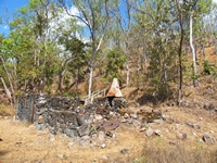
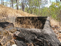
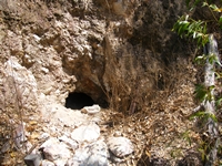
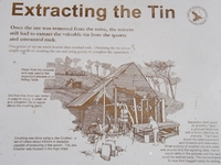
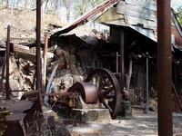
This small scale, labour intensive mine operated without the benefit of heavy earth machinery. Jaw crushers were used rather
than a stamp battery. Working in the shafts was difficult as the miners followed the horizontal seams of ore using picks and
shovels. It was even worse during the wet season as the water seeped in. The moist air was heavy with lung destroying
particles of silica. The mine leaseholders and Aboriginal workers began showing signs of Silicosis, and one of the leaseholders
subsequently died. Bats now inhabit the abandoned tunnels with at least five species of bats breeding in the old mines. Water from the spring fed creek was stored in concrete reservoirs on the hill and gravity fed into the mill to be used to separate
the heavier tin from the crushed ore.
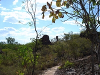
The first day at Litchfield National Park we viewed the magnetic termite mounds, visited the old Bamboo Creek tin mine site and took
the walk trail along Walker Creek.
An early start on the second day took in Blyth Homestead, Tjaynera (Sandy Creek), Greenant
Creek walk to Tjaetaba Falls and concluding the day with a welcome cooling swim at Wangi Falls plunge pool.
On our
third day we went early to Buley Rockhole and on to Florence Falls. Then we took the four wheel drive track into the Lost City. A short visit to the Tabletop Swamp was followed by the loop walk at Tolmer Falls. We concluded the day with a walk over the
top of Wangi Falls and another refreshing swim in the plunge pool.
Short walks in Litchfield National Park are outlined in this brochure
Copyright (C) 2013 AustraliaSoMuchtoSee.com. All rights reserved
See Question and Answer about visiting Kakadu and Litchfield National Parks here


