Australia So Much to See
The Darling Downs: Brigalow, Warra and Dalby
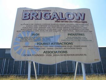
Brigalow: Altitude 309 metres
Average annual rainfall 650 millimetres
Railway line passed 1878
Bore depth 360 metres delivering 3,028
litres per hour
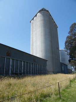
Vertical Munro Silos built 1963 with a capacity of 4,091 tonnes
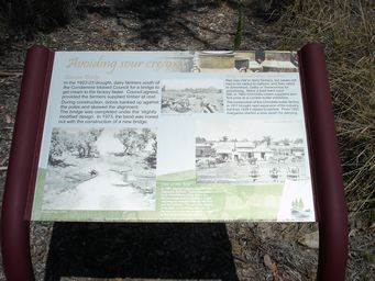
We took the Banana Bridge Road south from Brigalow to the Kogan Creek Power Station. Why the unusual road name? During
1922 and 1923 dairy farmers south of the Condamine River lobbied Council for a bridge across the river. At the time, the nearest
river crossing was at Archers Creek, near Chinchilla. With a perishable product, speed of delivery was necessary for the dairy
farmers to reach the railhead from where the milk was transported to the processing factories in Silverwood, Dalby or Toowoomba.
Twelve kilometres south of Brigalow, the Kogan Creek Power Station with 750 megawatt opened in 2007. Kogan Creek’s high quality
coal means lower nitrous oxide and sulphur dioxide emissions. The open cut mine is four kilometres from the power station, and
has estimated resources of 400 million tonnes. The plant uses 2.8 million tonnes per annum.
This power station will have the lowest greenhouse impact of any coal fired power station in Australia. There is also a high
efficiency filtering system to remove ash and dust from the flue gas before it goes up the 160 metre chimney. Waste ash from
the power station is mixed with a small quantity of water and pumped into ash cells back at the mine. When full, ash cells are
capped and revegetated with local vegetation.
Dalby is a large regional centre with a town population of approximately 12,000 and a further 5,000 residing in the rural district.
Central to one of Australia's richest grain and cotton growing areas, Dalby has the largest grain receival depot in Queensland. There are two Cotton Gins, and we passed one on the northern approaches to Dalby. On our previous visit, cotton picking was
under way with cotton being the predominant crop around Dalby.
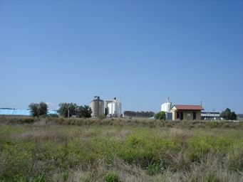
Malu railway siding north west of Jondaryan with several different grain bins. There is a quarry beyond the silos. The siding
building has since been demolished.
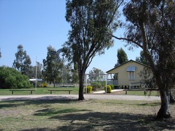
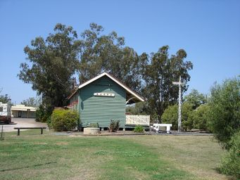
Restored former Warra Railway Station, in the Richard Best Memorial Park, which houses the Progress and Heritage Society Museum.
Picnic
facilities including seating, tables, barbecues, and toilets are available. Camping is allowed for a donation.
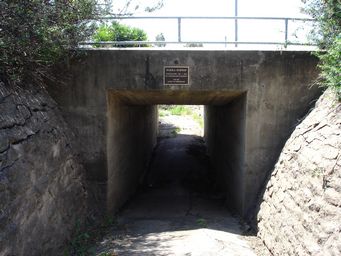
Nearby the Warra Subway has a walk trail under the railway line. The subway was constructed in 1911/1912 ‘for the safety of pedestrians’.
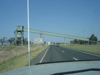
Coal from the Wilkie Creek is loaded to rail at McAlister using an overhead conveyor across the highway. Coal is exported from Brisbane to Korea, Taiwan and Japan. Commenced in 1994, the mine closed in 2013 as uneconomical with a drop in coal prices. It has since been sold with plans for production to be resumed.
The McAlister grain receival bins can be seen on left of the highway beyond the coal loader.
Haystack School building which was open from 1910 to 1968 near Warra. Originally the Daiwan School, it was renamed Haystack
in 1924.