Australia So Much to See


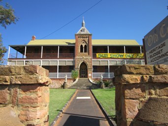
The first local government administration centre/office was built in 1898 in Northampton, new offices were built in 1957 and were extensively extended and modified in 1984 and again in 2001. The Kalbarri administration centre, being the "Allen Centre", was opened in 1992.
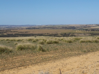
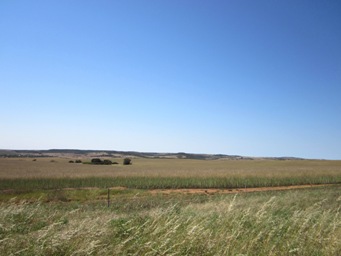
Northampton is the Shire headquarters for the Horrocks, Port Gregory, Kalbarri and Northampton towns and the Binnu and Ajana localities. The Northampton Ajana area is the northernmost extent of cereal cropping, predominantly wheat, in Western Australia. Flat topped mesas dominate the scenery from the highway.
Northampton has long been known by the Aboriginal people as Mooniemia.
Recorded history of this area dates back to 1629 with the wrecked Dutch ship Batavia and two men being marooned near the mouth of the Murchison River. See speculation on where this actually occurred in subsequent pages.
A convict hiring station was established at Port Gregory from 1853-1856. The first railway commenced in 1874 and was completed in 1879 running from Geraldton to Northampton, later being extended to Ajana in 1913.
With the railway came the expansion of the district's mining and agriculture, more lead and copper mines were opened up, cereal crops (mainly wheat) were increasing and sheep numbers also increased.
In 1860 Governor John Stephen Hampton resumed a parcel of 500 acres from pastoral lease 68 belonging to William Burges, which was part of the Bowes estate #. This was done to facilitate the improvement and settlement of the North Ward and establish a town in the Victoria district.
In 1863 the townsite was surveyed into blocks mainly one acre in size. In February 1864 Governor Hampton proclaimed the town and named it Northampton. Prior to this two mining villages already existed. Wanerenooka to the north and Gwalla to the south.
Copper was first found at Wanerenooka in 1855, and was the first mine in the Northampton area. It is the second oldest copper mine, and the third oldest mine overall in Western Australia. The ruins are at the northern outskirts of present Northampton town. See more about Wanerenooka on Mineralology Database
Opened in 1859, the Gwalla Mine was one of the best known of all the copper mines in the district. The Gwalla ruins are on the southern side of the town of Northampton. More about Gwalla on State Heritage
The new town grew in the Nokanena Brook valley centred at the Nokanena Brook Bridge, between the hamlets around the two major copper mines in the area, the Wanerenooka and the Gwalla.
In 1913 when the railway station was relocated to Mary Street, businesses also relocated further north in the townsite to be nearer the hub of commerce.
Lead ore was first found by explorer Pemberton Walcott, a member of A. C. Gregory's party, in 1848 in the bed of the Murchison River. By 1877, 4,000 tons of copper and lead were being produced each year. Read more about explorer Augustus Gregory's exploration and discoveries across Australia, and the legacy of places which now bear his name.
In 1936, 4,628 tons of lead were produced
from the Northampton field followed by 6,163 tons in 1937. Most of this came from the Grand Junction mine which was closed in 1938.
The
Northampton State Battery opened in 1954 and operated for about 30 years leaving large amount of tailings stockpiled. Locals removed
the waste to use in buildings and other construction works. The battery was demolished in 2010 with the examining tailings being sealed
in a containment cell.[8]
An investigation into lead contamination in the town commenced in 2013. The Northampton Lead Tailings
Project aims to collect information on all land parcels around the town to determine extent of the distribution of lead tailings,
which contain about 3% lead, in the area.
From Wikipedia
Built in 1858 by Francis W Pearson for the Geraldine Mining Company, the smelter was used until late 1859. The Warribanno Smelter Complex Ruin is the oldest identified European mining site in Western Australia and the smelter is the oldest surviving smelter in WA and one of the earliest in Australia. It consisted of one roasting and two large smelting (reverbatory) furnaces with a large chimney 105 feet above the works.
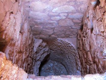
It was built into a hill so that the body of the hill could act as an oven. At the base of the chimney a large opening faced the direction of the prevailing westerlies, thus creating a natural bellows. Ore and wood fuel were thrown into the cavern and fired, causing the molten lead to flow out from an opening at the bottom and down a bricked channel, where it cooled and was loaded into small trucks on a very narrow gauge railway.
Bricks for the structure are believed to have been brought out from England. The first lead ingots were exported via Port Gregory in 1853. The chimney was originally about 50ft (12m) high. Figures for the export of lead indicate that the smelter worked principally between 1853 & 1859, and produced about 577 tons of lead. In 1979, the National Trust undertook conservation works on the site through the Geraldton Building Company. It is claimed to be the first smelter in Western Australia.
Close by were cottages for workmen, blacksmith shop, a quarry and a convenient supply of wood. The Warribanno smelter is one of a complex of sites associated with the Geraldine Mining Company, and with Port Gregory and the Lynton Convict Hiring Depot for the shipping and transport of lead, which caused the construction of wells along an overland route through Trevenson.
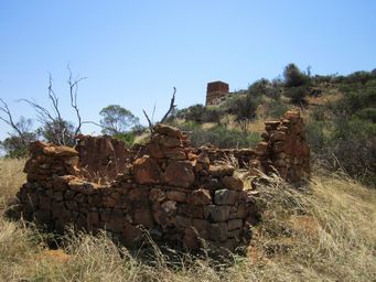
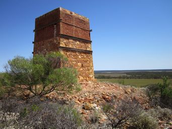
Warribanno Chimney
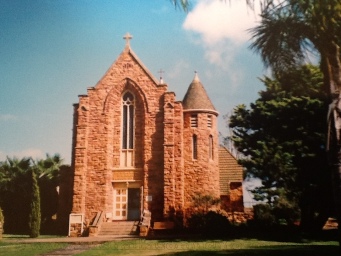
Two historic buildings stand along Hampton Street (North West Coastal Highway). Designed by Monsignor John Hawes and constructed
in 1919, The Convent of Sacred Heart was the home of the Presentation Sisters from 1919 to 1983. Nearby is the Gothic style
church of St Mary in Ara Coeli (which translates to St Mary of the Alter of Heaven) was also designed by Monsignor John Hawes.
The Geraldine Lead Mine, located approximately five kilometres north east, is the earliest European settlement in the Mid West of Western Australia.
Read more about the Geraldine Lead Mine in The first site for mining in WA
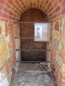
Looking down to the base, where the smelter fires were kept hot by air from the vents near the base of the hill.
Northampton - once known as "The Mines"
