Australia So Much to See
New South Wales - Dubbo to Wellington Caves
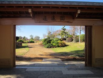
The new entrance gate 'sukiyamon' was constructed in 2013 by Japanese craftsmen. Enter a world of tranquility.
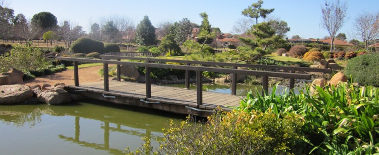
Before we left Dubbo, we went to the Orana shopping centre and the nearby Japanese Gardens; one of four themed gardens in the Dubbo
Regional Botanic Garden. Shoyoen is recognised as being one of the most authentic Japanese Gardens in Australia. It was
gifted to Dubbo by sister City Minokamo in Japan. Shoyoen was constructed and opened in 2002.
The dry garden landscape or 'karesanui' features gravel raked into patterns representing waves, while rocks or mounds represent mountains
or islands.
Thirty kilometres from Dubbo, Geurie is a small town with jogging, horse riding trails and mountain bike trails, with the later going
up the extinct volcano, Bald Hill.
The first race in Geurie was conducted in the streets of the village in 1896. In 1901 the race club purchased crown land and began racing in its present location, now known as the Geurie Sport and Recreational
Grounds. Annual race meetings have not been continuous, but currently a Picnic Race Meeting is help at the beginning of February
each year.
Camping is permitted at the sports grounds for $10 per night, where there are toilets, basic hot showers, water and
limited powered sites (may be only 10 amp outlets but were being upgraded). South of Geurie on the Macquarie River is Ponto
Falls Reserve, for picnics, boating, canoeing, fishing, swimming and camping. No facilities. It is seventeen kilometres by road
from Geurie, and signed from the Mitchell Highway.
The tea hut or 'Chaoya' is named 'Jurian' which means 'happiness and long life house.
Wellington is the second oldest New South Wales settlement west of the Blue Mountains. One of its hotels, the Lion of Waterloo,
established by Nicolas Hyeronimus in 1842, is the oldest operating licenced premises west of the Blue Mountains, and is believed to
be the site of the last duel fought with pistols held in Australia, in 1854. The exterior front wall of the Lion of Waterloo
is constructed of hand-cut ironbark slabs and inside some of the bricks still show the sign of the convict brickmakers. It is one
of the few remaining slab timber buildings still standing from the colonial era of Australia's history. The tavern once served
as a changing station for Cobb & Co coaches
As a regional centre Wellington benefited by the development of the gold mining
industry in the district from the 1850s. Initially this was working alluvial deposits of gold but later focused on the mining of quartz
reefs. Wellington is now a regional centre for agricultural industries.
A busy town with lots of shops open when we passed
in 2009, the town was much quieter this time, and looking sadder with a number of shops empty.
With so many lovely
historic buildings, there is a walk trail linking key buildings.
Wellington Convict and Mission Site - Maynggu Ganai. Wellington was founded as a convict agricultural station in 1823, the only Government settlement after Bathurst, west of the Blue
Mountains. In 1827 "special" convicts, i.e. middle class or educated convicts who were thought to be receiving special attention were
removed to Wellington to keep them out of sight. By 1831 convicts had erected buildings for the Commandant, military, stores, engineers,
blacksmiths, carpenters, government officials and the convicts as well as structures such as a lime kiln and stockyards. From 1825,
the settlement also housed the Police Magistrate, several constables and the Mounted Police.
In 1831 the convict agricultural
station ceased operation leaving behind only a small military presence. The London based Church Mission Society moved into the settlement
to create an Aboriginal mission. The missionaries abandoned the settlement in 1844. All buildings were removed, and building
materials used for building in the town of Wellington, which was proclaimed in 1846.
In January 1989, while attempting to cross
the Macquarie River, a Mack prime mover carrying a trench digger caused the Wellington bridge to collapse. The Mack truck and their
support utility both landed in the river. No-one was killed. Until December 1991 when the new bridge was completed, traffic on the
Mitchell Highway was diverted to a pontoon bridge as a detour. The bridge was part of a major artery to the north-west, as well
as for local traffic as the river divided the town in two.
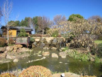
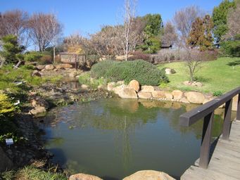
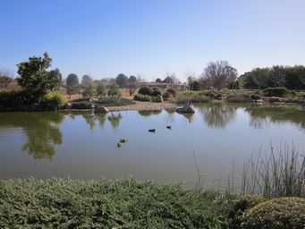
The waterfall, streams and lake symbolise human existence; birth, growth and death.
Japanese Koi in the ponds are 'living
flowers'.
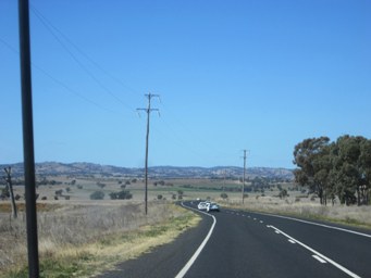
We headed south east from Dubbo via the Mitchell Highway, passing the small town of Wongarbon only eighteen kilometres from Dubbo,
and on into an undulating landscape. Wongarbon is a growing town, close enough to Dubbo for easy commuting to work.
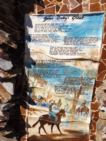
A delightful poem entitled John Oxley's Ghost (above left).
Just one verse:
I like to think the
name chosen to suit,
Came from a stone in his Wellington boot.
With the boot off, and the small pebble gone,
John Oxley eyed his worn
Wellington,
And thought to himself, and he gazed all around:
"Wellington. That's a good name for a town."
And the concluding
verse:
Wars and recessions, flooding and drought.
Those we survived. So why should we doubt?
Where is our faith, and the debt
we owe,
To those pioneers who died years ago?
A toast. To this town, with so much to give
To Wellington, this town where I choose to live.
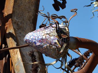
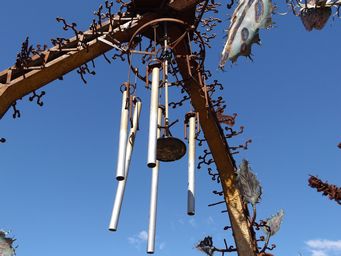
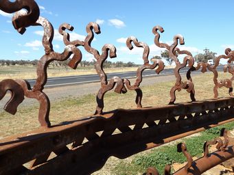
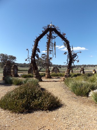
An unusual sculpture incorporating the girders of the collapsed bridge was constructed at the junction of the road into Wellington Caves complex and opened in 1996.
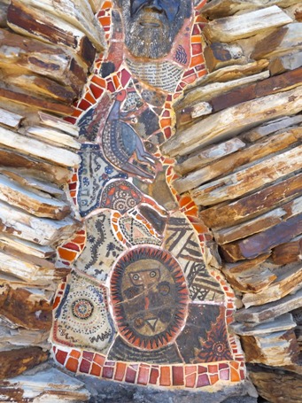
Created by sculptor Frances Ferguson with assistance from nine artists from the Orana Aboriginal Corporation, stonework by Ken Done, Flowers metalwork by David Hobba and glasswork by Brian Hurst There are two sections, the Pod, and the Wall which semi surrounds the pod.
The skeletal elements refer to the large numbers of fossils associated with Wellington
Caves, the dome suggests the sunset, the windchimes reflect the stalactites of the caves and the pool below them resembles the confluence
of the Bell and Macquarie Rivers. The seed-pod shape evokes the valley's fertility and the potential of the district while the 'plants'
which emerge from it refer to the area's growth and the particularity of its vegetation.
The wall, made from girders, and local
stone of quartz, basalt and shale represents the Catambol Ranges which lie directly behind the sculpture. The design in the
rockwork tales its inspiration for Wiradjuri art with the directional pattern of the stones, and the glass balls represent the spirit
of all the people who have lived in this land. Plaques along the wall, made from girders and stones, made by artists and school
children tell the history and Wellington.
