Australia So Much to See
The Princes Highway from North Adelaide to Port Pirie
This large town, with a population of around 30,000 is now considered to be an outer suburb of greater Adelaide.
In 1837
Colonel William Light, Surveyor General for the Colony of South Australia camped twice in a local area that became known as ‘Dead
Man’s Pass’ on the South Para river as part of his exploration of the Barossa Valley. Light recognised the potential of the location
for South Australia’s first country township.
Gawler is said to be the oldest country town on the Australian mainland, and is
named after the second Governor of the colony of South Australia, George Gawler. It is about 40 kilometres north of Adelaide.
Gawler
prospered early with the discovery of copper nearby at Kapunda and Burra, which resulted in Gawler becoming a resting stop to and
from Adelaide. Later, it developed industries including flour milling, manufacturers of agricultural machinery, mining and ore-processing
machinery and smelters for the mines of Broken Hill and the Western Australian goldfields, also steam locomotives and rolling stock.
With an interesting name, we had to find the Two Wells that occasioned the naming of this old town. Dating back to around 1850,
the town was at a site of two permanent Aboriginal waterholes. There are a number of old buildings retained in the town.
Two
Wells is a rapidly growing town, due to its proximity to Adelaide which is 40 kilometres to the south. Formulated in 2013, a thirty
year plan for Greater Adelaide includes developing Two Wells as a population centre. This will include a private school, and
housing developments to the north of the town which has commenced.
The Two Wells Tavern is said to have a ghostly occupant,
and old sea captain by the name of George who once rented and upper story room. First licenced in 1960 as the Two Wells Inn,
the hotel offers bar and restaurant facilities, and now has a ten roomed motel close to the tavern. This is one of two hotels
in Two Wells.
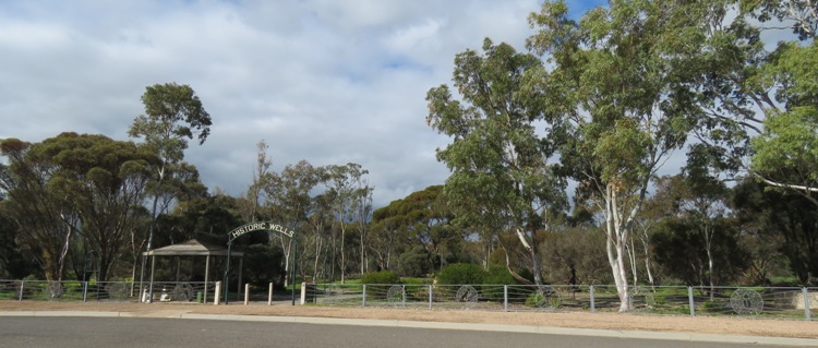
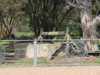
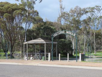
We visited the Two Wells, once used as the water supply for the town but abandoned when a pipeline brought
scheme water. The wells fell into disrepair and rubbish filled them. The have since been renovated as a feature of the
town, together with a walk trail and statues.
The area known as the Hundred of Dublin was named by the Governor of South Australian, Sir Richard Graves MacDonnell. It was named
after his birthplace, Dublin, the capital city of the Republic of Ireland. Hundred of Dublin which include the towns and localities
of Dublin, Windsor, Wild Horse Plains, Long Plains, Calomba and the coastal towns of Parham, Webb Beach and Thompson Beach. While settlers had moved into the area earlier, the small township of Dublin was surveyed in 1873 and gazetted on April 13, 1876.
In the 1990s the small town of Dublin fought unsuccessfully against a rubbish dump. The area was earmarked to have a large
waste dump built. Locals were concerned about the negative impact that the landfill and dumping would cause to the fragile environment.
The Gulf St Vincent is the 4th most important shore-bird site in Australia and, in South Australia, is second to the Coorong for its
environmental importance.
To the south of the town and on the east side of the highway, statues, made from farming scrap metal,
were built as a very public protest to the South Australian government's plans. First built was the Tin Man, then the Environmental
Observer and then came the Cockroach. Over time, a whole series of interesting and quirky sculptures appeared, including a rat, a
toilet and a spaceship.
While the campaign was unsuccessful, the junk art sculptures remained and have become a tourist attraction. I was more amused by the name of the laundromat in the town "Suds your Duds".
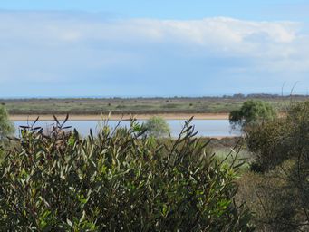
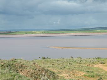
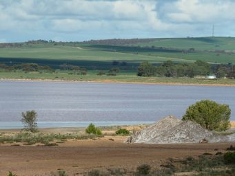
Before reaching Port Wakefield, we passed a number of small lakes, mostly on the west (coast) side of the highway, but some the other side as well. We stopped at a rest area by one of these lakes.
Distant hills of the Yorke Peninsula came into view
in the horizon, looking to the other side of the St Vincent Gulf.
From Port Wakefield we had the option of going to the coast through Kadina to Wallaroo at the northern end of the Yorke Peninsula, then straight to Port Pirie, but we needed to get to Port Pirie quickly so stayed on the Princes Highway, and in doing so, had the bonus of seeing Lake Bumbunga at Lochiel.
A good viewing and picnic area view the lake but we were at the wrong time of
the year to see the lake pink. Lochie the Lock (ness) monster made from tyres was well out of the water with such low lake levels,
so didn’t have the same impact. Lochie is viewed from a little further north than the main viewpoint, where there is an informal
track and parking area. Cheetham Salt mine salt on the lake (salt pile at right).
Resources
ABC News Two Wells set for Population Swell
Adelaide Plains Council – Dublin protest statues
Camping and Public Dump Points
Port Wakefield is at the head of the St Vincent Gulf, which separates the Yorke Peninsula from Adelaide.
Port Wakefield was developed to cater for the increased production of such commodities as ore from the mines at Burra, hay and wheat from the farmers both locally and surrounding districts.
The town grew steadily
and thrived on the emerging industries until the introduction of the railway system, after which the port town declined.
There were
a number of piggeries near the town, which has an abattoir for processing pork. Early in 2019 over 100 jobs were shed from the
abattoir, the scaling down due to a combination of factors. In part the drought has caused a high price for feed, making some
piggeries unviable, and in part a lack of demand for local pork. Due to costs, smallgoods manufacturers had turned to imported
pork putting further pressure on local industries.
I firmly believe that Australia should not import pork as there
is a risk of introduction of pig diseases, and additionally because we need to support our local producers and worker's jobs.
Gawler
Gawler Caravan Park $33 powered, $38 for large rigs, fully serviced, dump point.
Gawler Gateway Tourist Park. Five kilometres
south of Gawler and 35 kilometres north of Adelaide centre. $32 powered, $25 unpowered. Serviced sites, dump point. Close
to train to visit Adelaide.
Lower Light Hotel on Princes Highway, free for customers, toilet available only when hotel is open.
Mallala, while not on the route we took, is only 12 kilometres east of Dublin, has 72 hour free camping at the sports oval. Toilets. Update 2020: Lions Club managed Mallala Campground has new amenities block with coin operated showers and free barbecues. Camping now $10 per night. See Mallala Campground and book on-line, or pay at Hotel.
Dublin Public dump
point at Lions Park in town.
Port Parham, while not on the route we took, is only 6 kilometres west of the Princes Highway, 4 kilometres
north of Dublin. Free, toilets.
Port Wakefield Caravan Park $30, $20 unpowered, fully serviced sites, dump point. Council owned.
Lochiel allow overnight stays at their hall, but close to highway so noisy.
Snowtown (just off highway), toilets,
showers and power plus public dump point at Centenary Park, $20 powered (four sites only), $10 unpowered. Trains can be noisy
at night.
Redhill Ellis Street Reserve, no amenities, fully self contained only, 48 hour, $2 donation at store. Short
walk to toilets in town. Train audible at night.
Crystal Brook (just off highway). Caravan Park $29 powered, $20
unpowered. Fully serviced sites, dump point.
24 hour free camp at Jubilee Park for self contained, Railway Terrace, toilets, potable
water, dump point. Trains can be noisy at night.
48 hour honesty box donation camping at Bowman Park, five kilometres
north east of Crystal Book. Toilets, and picnic and barbecue area.
Warnertown, Flinders Rest Hotel. Ten kilometres
south east of Port Pirie. Free 24 hour customer parking behind hotel, no amenities. It appears that there is no longer
camping here.
Woolfwinch Caravan Park commenced in Warnertown subsequent to our visit, and has only 15 sites.
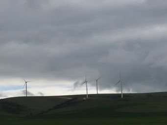
The Barunga and Hummocks ranges to the west was topped with wind turbines most of the way from Lochiel, past Snowtown to Hope Gap,
and again from Redhill northward.
Snowtown is just off the Highway. This small rural town came to fame for the worst of reasons following a series of murders
committed by John Bunting, Robert Wagner and James Vlassakis between August 1992 and May 1999. A fourth person, Mark Haydon,
was convicted for helping to dispose of the bodies. The trial was one of the longest and most publicised in Australian legal history.
Eight
bodies were found in barrels in the town's disused bank building. After more bodies had been found in suburban Adelaide the total
came to eleven. Only one of the victims was killed in Snowtown itself, and neither the eleven victims nor the three perpetrators were
from the town.
Just north of Hope Gap, a locality has the fanciful name of Lake View. There is a chain of small salt lakes in this area, but
the views are hardly inspiring.
Crystal Brook is another town by-passed by the highway. It is a grain receival point serving a reliable cropping area. The town is 18 kilometres west of Gladstone, in the heart of the magnificent wheat growing area of the Mid North. As a testament
to successful cropping years, in 2018 a grain train measuring 1.8 kilometres with 101 wagons was loaded with wheat at Crystal Brook.
In
the 1840s William Younghusband and Peter Ferguson established a pastoral property by that name 'Crystal Brook Run', which extended
across to Port Pirie and occupied 560 square miles (1,450 square kilometres). This was then purchased by the Bowman brothers
in 1852. The township of Crystal Brook was proclaimed in 1874.
The Crystal Brook, fed from a spring near Bowman Park, supplied
water to the town until 1890 when the Beetaloo Reservoir was completed, which at the time was said to be the largest concrete dam
in the southern hemisphere. Beetaloo Reservoir is in the Flinders Ranges approximately eight kilometres west of Laura.
The
town is around ten kilometres north east of the confluence of the Rocky and Broughton Rivers, and Crystal Brook joins the Broughton
River around ten kilometres west of the town.
Nearby is Bowman Park, a small reserve that is situated in the Crystal Brook
Valley and has an abundance of wildlife, and shady camping spots right next to the Crystal Brook Creek. The park contains history
that dated back to the 1800s. The ruins of the original Crystal Brook Run homestead built in 1850 where it overlooked Crystal Brook
can be seen via a walk trail.
With only grain receival bins noticeable from the highway, the small town is further back from the road. Redhill was at first
known as Broughton, being alongside the Broughton River. Port Broughton is 33 kilometres to the west, but this port is not on
the Broughton River mouth. The Broughton River meanders north towards Crystal Brook, and meets the coast in the within the locality
of Port Davis, south west of Port Pirie.