
Australia So Much to See

The Gibb River Road 2008 – the North East section takes us to El Questro station
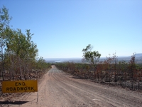
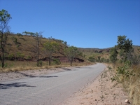
Back onto the Gibb River Road we continued in a north easterly direction. Although much of the country was drier than and not
quite as scenic as where we had travelled previously, it was still a pleasant drive on a good dirt road. After an overnight
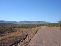
stop, we travelled through a scenic orange range until a vista opened up before us. Much of the scrub had been recently burnt.
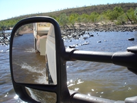
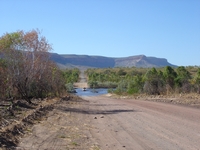
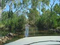
The road headed down the hill and along to the Pentecost River, where we waited for a vehicle to cross before we continued through. Wading is not recommended as this section of the Pentecost is in crocodile country, but the crossing was shallow and not difficult.
At this point, many turn back and return to the road via the same track. We continued the loop on a lesser used four wheel drive
track which has one steep entry and exit creek crossing.
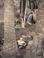
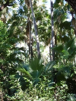
Next morning we visited Zebedee Springs, where a short walk from the car park through a creek line with lush livistona palms lead
to a series of waterfalls with small pools at their base.
The water is warm and the temperature of each cascade varies from hot to cool.
In the cool of the morning, people chose
a warm rock pool to sit in, or to feel the pounding pressure of hot water from a cascade.
Option 7 Donohue and Plenty Highways, the Tanami Road plus Gibb River Road to Windjana Gorge then back to Great Northern Highway and
to Broome 5,066 kilometres:
For a full outback dirt road experience including the beauty of the Kimberley, this is the ultimate drive. When travelling these roads, reduce tyre pressure and drive slowly. With a heavy rig, we found 25 psi cold was the best
compromise on tyre pressures for these corrugated roads.

Copyright (C) 2013 AustraliaSoMuchtoSee.com. All rights reserved
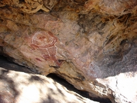
A little way further we passed a clump of boab trees then came to Matteo Rock. This 120 metre high sandstone outcrop is one
of many that have ancient Aboriginal rock paintings, although El Questro brochures are no longer permitted to identify areas of Aboriginal
significance.
These rock paintings were very different to those on the Mitchell Plateau with clean bright colours.
I wondered if they are either more recent in origin, or may have been ‘touched up’.
For those approaching from the East, the Gibb River Road is sealed to the El Questro turn-off. This was done subsequently
to our visit.
Check up to date accommodation prices for El Questro
Zebedee Springs is only accessible in the mornings as it is reserved for El Questro tour groups in the afternoons. Open to all
visitors 7 am to noon only.
Parking area is relatively small, so arrive early.
We were looking towards where the Durack and Pentecost meet and form the estuary which flows through the narrow Gut to form the West
Arm, from where it continues north and enters the Cambridge Gulf to the north Wyndham. The distinctive Cockburn Ranges dominate
the horizon.
After turning in to El Questro, we drove through some hills then crossed the Pentecost once again near the El Questro Resort.
This
section of road was quite corrugated, but is was being graded while we were there.
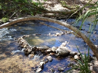
We chose Private riverside bush camping at El Questro, and although the Pentecost River is still in crocodile country, with shallow
water flowing across the rocks should a crocodile venture this far upstream there is a good chance you would see him coming. It is
not advisable to swim in deeper pools at all. Someone had cut steps into the river bank leading down to the water and to a small
‘bath’ built from rocks in the middle of the river. A very pleasant spot to sit and cool down in the flowing water.
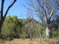
This bumpy boab tree was near our camp, and the background hill just across the river is Saddleback Ridge which glowed orange in the
setting sun each evening.
There are a number of self guided drives, walks and guided tours available at El Questro. We
chose to do a few of the self guided drives and walks during our three day stay. Leaflets on these drives and walks are available
at the shop.
We met some station cattle near the King River. El Questro Station which covers over a million acres is run quite separately
to the tourism venture.
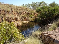
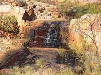
To the east of the King River is a loop drive. A side track from this goes to the pretty Tier Gorge, with a tiny waterfall trickling
over step like rocks and into a small pool. It was here that James Salerno, a former station owner, camped with 65 other people
from around the world for the Research 2000 Project to create ‘The Perfect Human Society’.
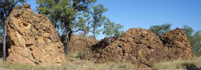
Nearby, the Remarkable Rocks are conglomerate clusters which are very different to the layered sandstone found throughout the area.
The track weaves through the clump of rocks.


