Australia So Much to See


From the South West of Western Australia this part of our journey takes us through the Pilbara to Wickham near Karratha
Heading back to Central Australia

In 2009 we left home on the 13th June and returned in the 8th November. Our total trip covered almost 22,000 kilometres
as we travelled through six states/territories, effectively doing a lap of Australia although only seeing a fraction of this
mighty country. Our priority targets were to see some of the northern part of the Northern Territory particularly Kakadu and
Litchfield National Parks as well as Darwin, and the fossil country of northern Queensland. Otherwise it was to follow
roads and see where they took us.
Here the first part of our journey sees us head north from our South West home and into
the Pilbara, although this journey includes some places previously visited, we take in some new sights as well.
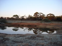
Taking the Great Northern Highway through a wheat belt just starting to turn green to Pithara, from where we drove east towards Kalannie to
spend a peaceful night at Petrudor Rocks.
Small pools on the low granite outcrop picked up reflections at dusk.
Resuming our journey back on the Great Northern Highway, we headed further north.
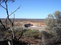
At Mount Magnet, we drove to Warramboo Hill Lookout over the early and modern mines near the town. These mines are now all closed. When we were at Mount Magnet the previous year, we heard that the mines were closing.
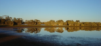
There was water and abundant bird life in Lake Nallan, which is a popular spot to stop alongside the highway to the north of Cue.
We had travelled along this narrow isthmus onto a virtual island, however access to this particular section is no longer permitted
for conservation reasons, and camping around the lake has since been confined to the south side of the lake.
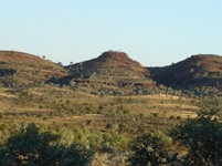
Having been on this Highway before, we continued on through Meekatharra and Newman, stopping at a lovely rest area at Mount Robinson,
with views across to The Governor. To the north we looked across to these hills.
Behind us was a small gorge and the start of a track up to the top of Mount Robinson. It was starting to rain so we did not
walk far up the hill.
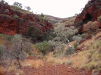
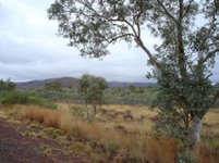
Climbing higher, we headed towards Tom Price, crossing a pass at the highest point of our Western Australian travels at over 800 metres
above seal level.
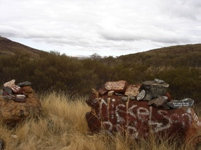
On a hill near the pass is a small rest area known as R.I.P. Memorial stones surround the
parking bay in memory a relatives and friends. It appears the epitaphs are increasing.
A huge iron-ore deposit at Mount Tom Price was discovered in 1962, and the Hamersley Iron Project was established. The mine,
the towns of Tom Price and Dampier, and a railway line between the two were established. Today, the neat mining town is an oasis in
the dry red countryside. On the western end of the Hamersley Range at an altitude of 747 metres, Tom Price is the state's highest
town.
Next we visited the mining town of Paraburdoo. The town was not as neat and green as Tom Price. As we headed
further west the spinifex covered hills soon gave way to lower hills covered with scrub.
We continued west, still
under a cloudy sky through lovely red Pilbara hills.
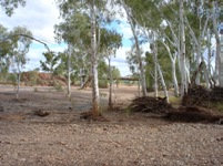
Main Roads WA services a number of good overnight rest areas, and we stopped here on the Beasley River. The camping area
is along what used to be the road and an old concrete river crossing. The new bridge can be seen in this picture. Pilbara
river beds are dry most of the time, however cyclonic rains can bring huge amounts of water and flood the surrounding land. The Beasley River is a tributary of the Ashburton River.
The land became flatter as we headed west from the hills and through cattle stations. Mount de Courcy is a prominent mesa
as we neared the Coastal Highway. Just north of Nanutarra Roadhouse, we turned onto the Highway and headed north.
South of Karratha, Miaree Pool is a popular picnic spot but camping is no longer permitted, but watch for news as a 24 hour only rest
stop is being negotiated. This pool on the Maitland River is lovely, and not far from the bridge where the highway crosses high
above the river. The Maitland Bridge can be flooded in cyclone season and in 2004 was partially washed away, isolating
Karratha from a direct route to the south of the state and supplies from the south.


We had previously visisted Karratha, a modern town built to support the mining industry, and further north, the historic old town
of Roebourne. We made our way to Wickham, a neat town built by mining industry to accommodate workers.
Copyright (C) 2013 AustraliaSoMuchtoSee.com. All rights reserved
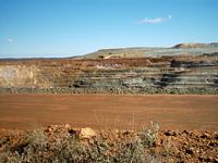
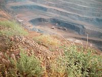
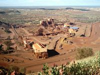
Meekatharra gold mine which was owned by St Barbara Mines at the time of our 2003 tour
We had previously visited Newman and taken the Mount Whaleback open cut iron ore mine tour.
# While Tom Price (formerly known as Mount Tom Price) is the highest town in Western Australia, the highest mount was not far
away in what is now Karijini National Park. Mount Bruce (Punurrunha) peaks at 1,234 metres above sea level and is 38 kilometres
east of Tom Price. It is still shown in some publications as the highest peak. An easy short walk gives views across the
Marandoo mine rail loading facility. Continuing a walk trail totalling nine kilometres return takes you to the summit.
Surveyors in 1967 discovered that a point known to the local Aborigines as Wirlbiwirlbi was in fact fifteen metres higher than
Mount Bruce, being 1,249 metres above sea level. It was named Mount Meharry in honour of surveyor William Thomas Meharry, who
was Chief Geodetic Surveyor for Western Australia from 1959 until his death in 1967. Mount Meharry is 62 kilometres south east
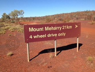
of Mount Bruce. It can be reached from a 13 kilometre road from the Great Northern Highway then a 21 kilometre
four wheel drive track, or alternatively via tracks through Juna Downs from the Karijini Tom Price Road. Permission should
be sought from Juna Downs Station (now owned by Rio Tinto) and Department of Parks and Wildlife.
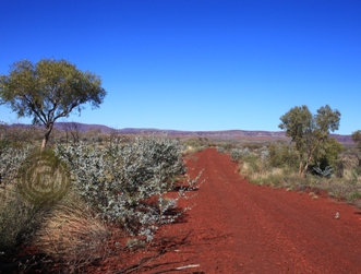
Turning west through Karijini National Park, the clouds were unusually low and obscured the peaks of the hills. We
did not visit the spectacular gorges as we had done so on a previous trip. See Karijini Brochure and walks.


