Australia So Much to See


Albany today and the Torndirrup National Park
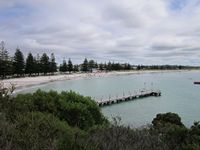
Ellen Cove, Middleton Beach and Oyster Harbour
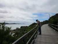
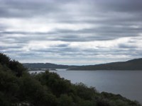
From Ellen Cove, a boardwalk climbs above the rocks of Point King and a walking trail follows the coast around into Princess Royal Harbour to Albany Port. This walk takes about an hour one way, and has great views of Middleton Beach, into Oyster Harbour, sweeping views across King George Sound, the Vancouver Peninsula and Princess Royal Harbour.
Albany and surrounds today

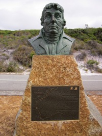
On the 19th October 1800, the Baudin Expedition set sail from Le Havre in Normandy, France with two ships. Separated by storms, the two ships charted the Western Australian coast independently from Cape Leeuwin in the south west corner to Joseph Bonaparte Gulf near Wyndham in the north. With 23 scientists in the party, over 200,000 specimens of flora and fauna were collected. The Expedition was responsible for hundreds of French place names in Australia, of which around 240 are still in use in Western Australia. Baudin charted nearly two thirds of the Australian coastline.
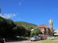
Albany 1896 former Post Office building is a heritage site in Stirling Terrace. The site was also a Customs office, a base station of the overland telegraph, and is noted for its architectural and historical significance. It was listed by the Register of the National Estate in 1992.
The City of Albany and the University of Western Australia raised funds from state and federal sources to renovate the site, adapting it to become the Albany campus for UWA and Curtin University. This was officially opened in 2002.
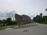
The resemblance of the natural rock to a dogs head was recognised thousands of years ago by Aborigines in the area who called the rock Yacka. A collar has been painted on the dog in more recent times to make it obvious to drivers and pedestrians.
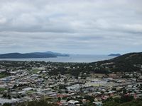
The communications tower atop Mount Melville has two levels of observation decks, giving views across the town and Princess Royal Harbour as well as to the west and the north of the town.
On the rugged Torndirrup Peninsula you will see the features of the Torndirrup National Park, and visit Whale World at the former whaling station.
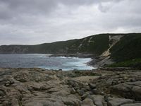
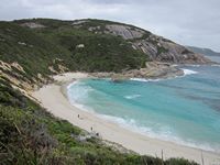
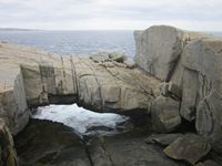
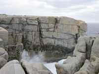
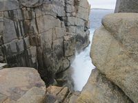
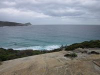
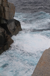
Torndirrup National Park features windswept coastal heaths, granite outcrops, sheer cliffs and steep sandy slopes and dunes. The Southern Ocean foams under a Natural Bridge in the coastal granites and formed The Gap, where the waves rush in and out with tremendous ferocity. A crack line in the granite 'blows' air and occasionally spray
This well known channel has taken lives, so treat with caution. Waves can come right up onto the surrounding rocks and the rocks can be slippery in any conditions. There is a small lookout with guardrail and going outside of this is not recommended. Even on a calm day, the swirling eddies of receding water and no way out show the danger of the site.
A short walk down a well made path shows the well known natural bridge, where waves foam under this arch.
A short road off the road to The Gap goes to the parking area for Cable Beach, where a lot of steps take fishermen to the beach. There is also a track to walk to the top of the hill to Cave Point Lighthouse.
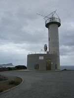
Cave Point Lighthouse in the Torndirrup National Park is a short walk from a car park just off the road to The Gap. This lighthouse was built in 1976 and is the site of one of two Australian Cospas-Sarsat satellite ground receiver stations. This is an international satellite aided search and rescue system that detects emergency beacons.
From the Blowholes car park there is an 800 metre walk which includes 78 steps to a rock ledge where the blowholes in cracks in the rock below roar like thunder with occasional spray visible. Sea and weather conditions give varying results and spray can spurt up to three metres. With a sharp drop from the edge, it was not a place to go to the very edge to try and see more. Bands of black laval rock are seen in the granite.
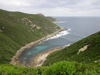
This small inlet is known as Jimmy Newells Harbour, although who it was named after is the subject of speculation.
One story is that it was named after convict James Newhill who it is said was caught in an unexpected storm and driven into the shelter of the harbour. Newhill was one of the 121 New South Wales convicts brought to Albany by Major Edmund Lockyer in 1826. After serving his time, Newhill remained in the area, sailing around the coast hunting mutton birds and seals. He died at Albany in 1855.
The alternative is that it was named after Jimmy Newhill, a deserter from an American whaling ship, who hid on the Torndirrup Peninsula and was eventually captured near this site. He worked on a chain gang building roads in the area and married and settled in Albany.
The spelling of the site has been recorded as Newell not Newhill.
There are also a lot of steps to the small fishing beach known as the Salmon Holes, near the tip of the Torndirrup Peninsula.
This is the furthermost point within easy driving.
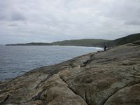
There are a number of stunning lookouts and walk trails in the park, including Sharp Point, Jimmy Newells Harbour, Stony Hill, Peak Head, Salmon Holes, and Bald Head or you can visit secluded Misery Beach.
Mount Melville was temporarily closed to the public commencing May 2023 due to anti-social behaviour, littering and graffiti at the site. It has remained closed.
