Australia So Much to See


Copyright (C) 2015 AustraliaSoMuchtoSee.com. All rights reserved
< Previous
travasmtc2014b030001.gif
Next page >
Home
Travelogues
Tips and Hints
Lists and Links
Q & A
Contact
< Previous
travasmtc2014b030001.gif
Next page >
Home
Travelogues
Tips and Hints
Lists and Links
Q & A
Contact
tn_castle_rock_climb_dscf2952s.jpg tn_castle_rock_trail_dscf2957s.jpg tn_castle_rock_trail_dscf2960c.jpg tn_castle_rock_trail_dscf2966.jpg tn_banner_castle_rock_skywalk_view_dscf2992ac.jpg
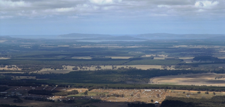
A view across farmlands to the harbours at Albany, from Castle Rock Skywalk platform, in the Porongurup National Park, thirty kilometres east of Mount Barker, Western Australia. 
 

Castle Rock – A high point in the Porongurup National Park

The Porongurup National Park is a small rocky range which features a pocket of Karri trees, far from the main Karri forest belt which stretches from Nannup and Manjimup in the north west, down to Walpole and Denmark in the south east.  Karri trees also occur on Mount Manypeaks  to the south east.   


One of the early popular walks in the Porongurup Range is Nancy’s Peak, which passes the “Tree in Rock” where a Karri tree appears to be sitting on a rock, while its roots have penetrated through fissures in the rock to survive and grow over many years.  I had climbed Nancy’s Peak before.  Devil’s Slide which climbs to the highest peak of the range, and other listed walk trails were not taken. 


This time we were destined to the dizzy climb to the top of Castle Rock, which has sheer drops on all sides.   The viewing platform clings around the edge of the rock, with a massive drop beneath you. 
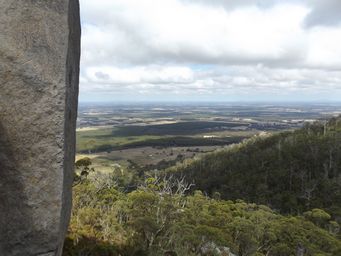
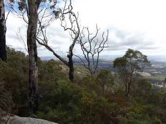
We commenced our walk up a climbing trail through forest, taking a breather to enjoy the view to the Stirling Ranges to our north (at left).
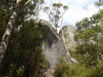
We were climbing past boulders (at right) as tall as the Karri trees.
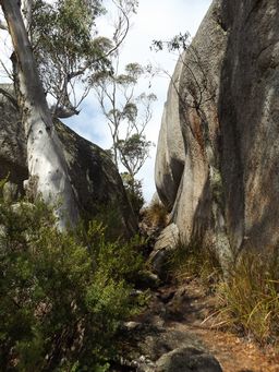
The trail passes large rocks, or goes over them, under them or through them.  The trail now has metal grab handles to make the climbing easier.  Some of those for the climb at right were too far apart for me, so scrambling was required, or teamwork. 
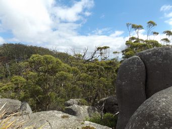
Now overlooking the treetops as the trail rises higher.  We are getting near the final prize. 
tn_castle_rock_sheer_dscf2973s.jpg tn_castle_rock_trail_dscf2969.jpg
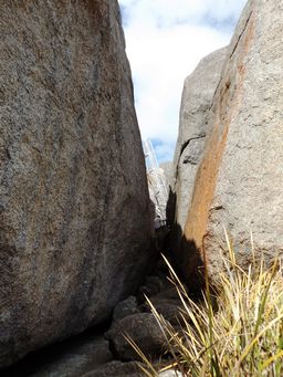
The chasm ahead doesn't look daunting, and there are handles to cross a rock toward the end, although I found it easier to slither under than over; the rock is higher than it appears.
 
The ladder is on view; we are nearing the summit.   
tn_castle_rock_sheer_dscf2972.jpg
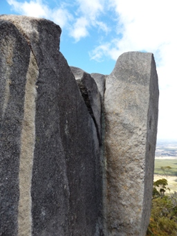
Castle Rock has perpendicular sheer sides, with a huge drop on three faces.
 
Light and dark bands can be seen at right, a legacy of the rock's formation from Magna. 
At left and above right show the rock face and views from the base of the ladder.  Even if you go no further, you have a good view to the coast, and have achieved a challenging but not extremely difficult climb. 
 
 
Back to Top ^
Continue reading >
Want to know more?
Contact Us
tn_balancing_rock_dscf2958.jpg

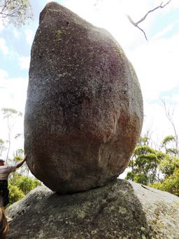
Along the trail, Balancing Rock is yet another example of granite rocks eroding to leave a tall rock seeming to defy gravity and defying the elements.  This one appears to be sliding down the sloping rock under it. 


We have seen the huge balancing rock at Girraween National Park in New South Wales.


There are many rocks balancing at the Devil’s Marbles in the Northern Territory.


A smaller rock is perched on a slope on Beringbooding Rock in Western Australia.

Home > Travelogues > 2010-2017 Travelogues Index > Mount Barker > Castle Rock, Porongurup National Park
TravASMTC2015 a