
Touring the East Kimberley 2008 – Wyndham and Kununurra. We reach Kununurra and explore the Ord River from the Ivanhoe
Crossing to Lake Argyle.
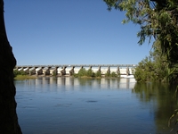
Lake Kununurra Diversion Dam was constructed to dam the Ord River for the new irrigation agriculture scheme in 1963. Since the
1972 construction of the huge Lake Argyle, water is released to maintain a constant level in Lake Kununurra. Properties downstream
of the dam have irrigation water supplied through channels which are mostly gravity fed. There are a lesser number of properties
upstream from this dam wall, and those with lake frontage pump water directly from the lake. A pumping station supplies water
to other nearby properties.
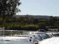
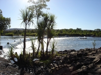
Water flows fast across the Ivanhoe Crossing, downstream of the diversion dam. This was the only Ord crossing prior to the construction
of the Diversion Dam. The present Ivanhoe crossing was constructed in 1952.
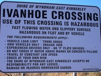
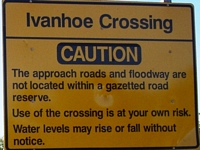
Signage on the approaches to the Ivanhoe Crossing to the north of Kununurra.
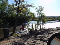
We watched a young lady in a Hilux drive across at a speed that created quite a bow wave.
Shortly after this, a man in a Landcruiser took the crossing at a sensible speed, creating no waves.
Travellers we met along the way highly recommended taking the Triple J Tours cruise up the Ord River to Lake Argyle. We highly
recommend it too. It is a most enjoyable day, and the guide gives talks on a variety of topics about the area, the Ord River irrigation
system, plants and wildlife. Regardless of what tour you choose, pick up from your accommodation in town is included to minimise
parking congestion. Bookings can be made from most caravan parks and other accommodation venues.
As the boat travels quite fast in some sections, it can get cold when on the boat, so taking a jumper or jacket is recommended; even
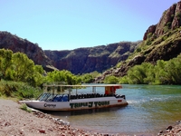
on a hot day. We were on the ‘Osprey’, which is a wide flat bottomed boat that seats around 48 passengers.
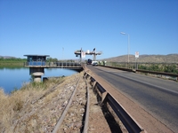
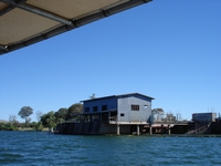
Near the diversion Dam wall is the old pumping station and pump house. This was used to deliver water to the plantations of
the lower Ord when the water in the lake fell below gravity feed level, prior to the construction of Lake Argyle. Water released
from Lake Argyle now ensures these low levels do not occur. The pump house is shown here whilst being converted into a restaurant.
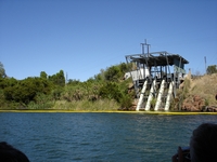
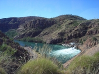
Water rushes out the sluice gates from the dam wall into the surging lower Ord. Depending on how much water is let out, the
Ivanhoe Crossing can be hazardous to cross.
Looking from the fast flowing waters towards the Diversion Dam wall. Downstream of the wall can be inhabited by salt water crocodiles. They are rarely found upstream from the dam.
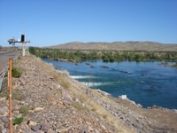
Upstream from the dam is the Packsaddle pumping station. This provides water for those plantations in the Packsaddle area that
do not have direct access to the water frontage. The fresh water is beautiful and used in the houses drawing from the
Ord without treatment.
The spillway from Lake Argyle is some distance from the dam wall, where a two and a half kilometre channel has been cut to create
Spillway Creek, which joins Stonewall Creek and generally flows quite strongly back into Lake Kununurra.
Water is discharged to maintain the level of Lake Kununurra. During the wet season, discharge through Spillway channel and Stonewall
Creek can be enough volume to fill Sydney Harbour every eight hours.
The boat took us a little way up into the creek, which was
visibly flowing.
We stopped to identify trees and birds nesting in them along the water’s edge before the boat turned around to leave Stonewall Creek.
This narrow chasm with water flowing into the river is known as ‘the hole in the wall’. The wall is sheer rock. Side streams
like this would be awesome to see in the wet.
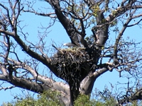
A large sea eagle was nesting high in a tree alongside the river. The sea eagle is the second largest Australian eagle, being
second to the Wedgetail Eagle.
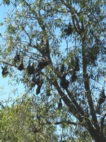
We stopped by a large colony of fruit bats. These noisy creatures were crowded into a group of trees.
They
hunt nocturnally and rest during the day, but the chatter continues.
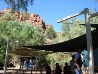
A wonderful lunch was served at a secluded riverside picnic grounds.
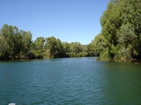
Although rising slightly as we headed up the Ord, the waters held by the diversion dam were fairly calm, flat and relatively wide.
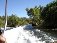
Further upstream, the Ord River flows rapidly through narrow channels amongst islands of reeds. The ‘Osprey’ captain needed
speed and navigational skills to negotiate this section.
Views from front and back of the boat whilst negotiating the narrow channels.
As we approached the dam wall at Lake Argyle, water was seen gushing from a pipe. Additional water was being discharged
as the hydro-electric power plant was not operating, and water normally used to run the turbines underground was released. Kununurra
had no power during this power plant outage. The power plant provides power for the entire Kununurra region and the Argyle Diamond
Mine. Lake Argyle was completed in 1972, with the wall being raised in 1996 and the hydro-electric power plant commissioned
in 1997.
We left the ‘Osprey’ and crossed the dam wall by bus.
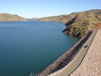
The force of water being released can be clearly seen when looking down from the dam wall.
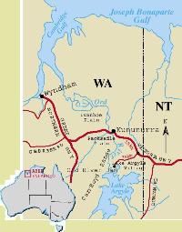
Having crossed the wall, we looked across what portion of Lake Argyle is visible from this point. The map hereunder shows the
full extent of the very large dam. This body of water is so huge, that it is classified as an inland sea, and holds around 21
times the amount of water contained within Sydney Harbour.
We chose the tour coach return to Kununurra without taking a further cruise in the waters of Lake Argyle. Our bus took us to
the small Argyle Village. Once the site of the construction crew camp, it now has accommodation, caravan park and a small shop.
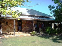
Our tour coach then visited the Argyle Station Homestead Museum. The historic Durack family Homestead was being flooded by the
dam, and due to public pressure, the homestead was re-constructed on a site near Argyle Village. The outbuildings were not recovered. It contains memorabilia of the Durack family and the era. Not the original station homestead, this homestead was originally
constructed in 1894.
At present 14,000 hectares are irrigated in the Ord River Valley. There are plans to open up a further 60,000 hectares to the
north of the present irrigated area and 10,000 hectares to the north west. For further information about the Ord
River Irrigation scheme read Lake Argyle Statistics 2008.
We will see more of the crops grown in the Ord irrigation area in subsequent
pages.
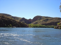
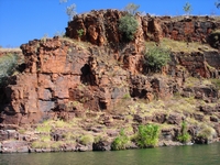
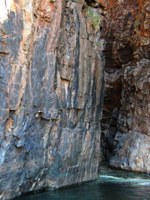
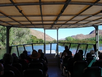
We passed orange cliffs then lower barren rocky hills along the lake edge.
More about the Ord River and surrounding from our stay in Kununurra on further pages
Ivanhoe Crossing, which has been closed to all traffic for the past two years re-opened to high clearance 4WD on 27th May 2016
Australia So Much to See
Copyright (C) 2013 AustraliaSoMuchtoSee.com. All reights reserved


