Australia So Much to See


To the Northern Territory and back to Western Australia Keep River National Park , travel
along the Duncan Road
Soon after entering the
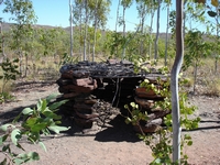
Heading north through the park, Ginger Hill is the next signed stopping point, where an Aboriginal bird hide has been re-constructed. A hunter would light a small fire near the hide, as smoke attracts the birds of prey who find animals and insects escaping from fire
an easy source of food. Crouching inside the small enclosure he would hold a stick with a few feathers on it protruding
through the roof of the hide. If a hawk came to catch the ‘bird’, the man would reach through and catch the hawk.
The
We chose Jarnem, the northernmost of the two park campsites, and found a shady spot to wait until it cooled down in the afternoon
before taking the Jarrnam walks, which can be combined into the one circuit walk of eight kilometres. To get to the circuit
involves a walk across a grassy plain. After then walking around a hill, a side track took us to the top and a lookout giving
views all around us.
We were very disappointed that the Nganalam rock painting and petroglyph site had been closed to the public, as this
site is known for its spectacular etchings, paintings and hand stencils. The closure of this and other sacred sites to
the public within the park is permanent.
We left
It was our original intention to visit the
A little way further east along the Victoria Highway we turned south onto the Duncan Road, which was at first wide and in good condition
as it traversed through stations with Brahman cattle. Even in the daylight, kangaroos were foraging alongside the road. The road soon became narrower and stony, but still easy driving. Before long we crossed back into
To the east we looked across the
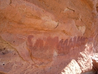
We reached the ridge near a small Aboriginal rock painting site at Nilgi Gap.
To the left, a more recent long straight crack can be seen. Erosion of such cracks over a very long time creates the dome shaped rocks.
Back to the access path through the grassy plain, there were a number of species of cockatoos; red tailed blacks and white tailed
blacks, as well as large white corellas in the small trees and on the grassland.
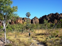
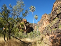
The walk along the edge of the ridge took us through semi shady forest with livistona palms and pandanus as we passed the various
eroded rock formations of the ridge.
Next morning we took the Keep River Gorge walk following the river where it has cut a wide passage through the sandstone rocks. Aboriginal paintings can be found along the edge of the gorge, but as these are not signed. They can be found if you watch carefully
for them where there are overhangs. This display includes reptiles and outlines of hands.
The overseer of a nearby Aboriginal owned station visited us, to warn of a dangerous feral sow which had been seen in the area, had
killed a dog in an Aboriginal settlement and attacked a person there. He manages over 25,000 head of cattle. Over the
past four years, he has shot over 14,000 feral donkeys.
Next morning we spoke to a lady who is a currently cook at the station. She was spending her day off relaxing and fishing
at the river pool.


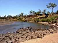
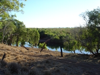
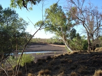
We took a walk along the river bed to the concrete causeway where the road crosses and looked upstream. There was not much water
flowing through. The
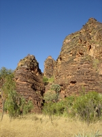
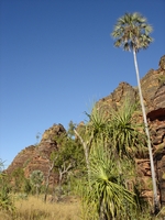
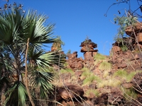
These sandstone chimneys are in a cluster of rocks with a 'lost city' appearance.