Australia So Much to See


To the Northern Territory and back to Western Australia– several times. We continue to travel along the Duncan Road to
Old Halls Creek, Halls Creek, view Wolfe Creek Meteorite Crater accessed from the Tanami Road, and take the Tanami Road to Alice Springs
2008.
Continuing south on the Duncan Road, we travelled for a little while in the Northern Territory before crossing back into Western Australia
again. The Bungle Bungle Range was in the distance to the west. After a while the scenery changed from spinifex and grassland
plains to scrublands and undulating gorge country until we reached the junction with the Buntine Highway which heads east into theNorthern Territory while the Duncan Road turns west. We visited the former Nicholson Station. This station is
now a Heytesbury property, and the pastoral side of the station is run from Flora Valley Station. Nicholson Station homestead
has a collection of houses and accommodation which had become derelict and was going to be demolished. They were saved when
the dwellings were taken over by Ord River Resources Ltd, as this company has geologists in the area looking for copper and bauxite
sites.
Some of the buildings are being used as headquarters for the Kimberley Cane Toad Busters; a group of volunteers
trying to prevent the dreaded cane toads making their way into Western Australia. Read about their work, the spread of cane
toads into Western Australia and the devastation they are causing to wildlife here
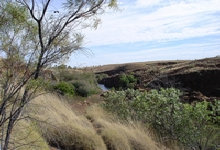
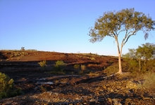
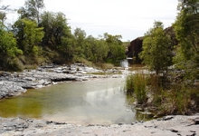
We parked at roomy flat area and walked a little way down to a stream with small pools. The sun was low and the red of
the rocky ground intensified. Sharp rocks alongside a pool were in layers of cream and red.
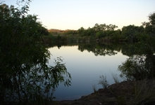
Another short track leads to Marella Hole, which is quite a large pool.
We explored the other tracks, at first crossing a stony washed out creek line. Side tracks lead to lookouts over the gorge.
The main track ended at a creek which was in a substantial cutting, and we were able to walk down the creek, being careful not to
slip on the wet rocks. Water was oozing out of the hillsides into the creek and its rocky pools.
We walked following the creek line to where the water tumbles down some distance into the Nicholson River way below us.
Looking way down into the river from the top of the creek’s cascade.
We walked a little way further along the top of the gorge, looking downstream along the river gorge which runs for forty kilometres. The Nicholson River joins the Ord River where the latter forms the south eastern boundary of the Purnululu National Park.
After leaving Marella Gorge we followed the Duncan Highway further west through cattle stations, passing through flat areas of grasslands;
treeless except for the creek lines. This section of grasslands drains south into the desert, in contrast to where we have been
where drainage was into the Ord River or Lake Argyle. The scenery changed again to eroded hills and drainage here was north
towards the Ord River. The hilly terrain towards Old Halls Creek was quite scenic and fairly barren.
A pretty spot alongside the road 45 kilometres from Old Halls Creek is Palm Springs, where a palm lined small pool is at the
base of a steep red hill. There are a number of other pools, such as Sawpit Gorge and Caroline Pool nearby which we did not
visit.
At Old Halls Creek, once the centre of a thriving gold mining industry, street signs and remnant ruins show the extent of the original
town when it had a populations of around 3,000 people.
Leaving Halls Creek on Great Northern Highway we headed west to the Tanami Road turnoff, then travelled through cattle stations, most
of which are run by a Kidman cattle company. There was considerable road works and re-alignment being undertaken on this first
section of the Tanami Road.
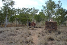
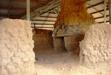
A group of mud brick building ruins has been preserved under a roof. The bricks were made with termite mound mud and spinifex. In 1885, it was the centre of Western Australia’s first gold rush, which was short lived, although fossickers still find gold in this
area.
Commencing in 1948 a new town on what is now the Great Northern Highway became known as Halls Creek, fifteen kilometres
away from what became known as Old Halls Creek. With the departure of the gold seekers, the old town had run its course.
The old township was finally abandoned in 1954, apart from an old hotel offering accommodation and a small camping area.
After spending the night in at the Halls Creek Caravan Park, we fuelled up and purchased final provisions for the Tanami Road.
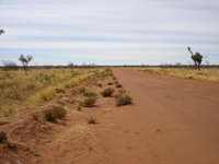
The track into Wolfe Creek Crater was quite corrugated as it passed through the station and past abandoned station buildings.
In the flat terrain, the crater can be seen in the distance.
Although it has long been known to Aboriginal people, who called it Gandimalal, the Wolfe Creek meteorite crater was only discovered
by Europeans in 1947 during an aerial survey.
Wolfe Creek Crater is the second largest crater in the world where meteorite fragments have been found. It lies on the edge
of the Great Sandy Desert amidst extensive spinifex plains. The average rainfall of the area is 400 mm per annum, but with an
evaporation rate of 3,000 mm per annum, it really is desert country.
Dating of the crater rocks and analysis of the meteorite fragments have shown that a meteor of over 50,000 tonne crashed into the
Earth around 300,000 years ago - relatively recently, in geological terms. Fragments of the meteor have been found up to four
kilometres away from the crater.
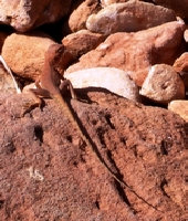
Tiny brown ringtail dragon lizards abound in the rocks around the rim, with their spotted bodies and ring striped tails.
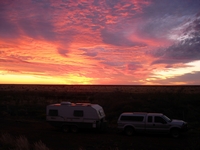
Heading east along the Tanami, we camped at an old gravel dump where we enjoyed a peaceful night after a colourful sunset.
A
pile of feathers indicated a bustard had been eaten; perhaps by an eagle.
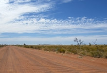
After the Balgo Hills turnoff, the road became markedly worse. Not only was it badly corrugated, but wash from the last time
it rained had left rills across the road. In some places, people had made side tracks along the edges of the road, and these
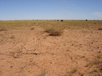
too were as corrugated. Much of the countryside was spinifex plains. Any distant ridges were quite low. Driving
required constant vigilance.
There was a bit of respite from the corrugations and washouts around the Coyote mine site, where they had maintained the road through
their lease . Here it was a different soil type where scrublands grew instead of spinifex.
Soon after we entered the Northern Territory, the country became undulating and the road was no longer straight. The road condition
improved in the vicinity of the Tanami Mine until after The Granites mine. Both mines are run by Newmont Mining Corporation. The area is rich in gold, and Newmont has a number of mining leases in the area. They obtain adequate water supplies from bore
fields fifty kilometres from The Granites mine.
We called into the quaint Rabbit Flat Roadhouse, but it was locked up with no-one in sight except for a very old grey dog who greeted
us. Diesel price on the pump was by far the dearest we had seen. We had enough fuel, so continued on. Update: Rabbit
Flat Roadhouse no longer operates as a fuel outlet, closing late in 2010.
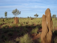
These large termite mounds were alongside a rest area near The Granites mine where we stopped for the night.
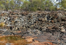
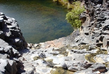
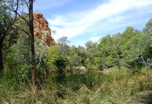
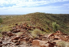

Rocks like stacks of bricks were stained with white from oozing water heading into the green creek.
Further south, smaller termite mounds in a barren landscape.
The terrain became undulating again, and we passed through Aboriginal lands as well as cattle stations which were in mulga country.
After another night in the bush near Yuendumu, we reached Tilmouth Well Road House. After the roadhouse, there was a narrow
bitumised strip for the rest of the way to the Stuart Highway to the north of Alice Springs. This ended our Tanami trip as we
settled into a caravan park not far out of town at Alice Springs to tour the red centre.
Copyright (C) 2013 AustraliaSoMuchtoSee.com. All rights reserved
The crater is 875 metres across and almost circular. The crater was probably around 120 metres below the surrounding plains, but due
to erosion is now around twenty metres below the plains. The floor is about sixty metres below the rim, and is fairly flat.
The outside edge of the crater rim.
We were privileged to have been granted permission from the station to visit Marella Gorge as this is on private property and not
open to the public. There are a number of tracks to explore.


