
Australia So Much to See

A. The road is notorious for corrugations. If you are familiar with the corrugations of Northern Territory roads such as the Tanami Road, this is no different. Even if graded, it is only a week or two away from being back to 'normal'. It took us all day - but only because another traveller had broken a spring on their camper trailer, and as we were one of the two travellers who stopped we helped them and followed them oh so slowly to Kings Canyon, stopping to help each time the temporary measures came apart on the corrugations. They had to spend the rest of their holidays waiting for a replacement spring. The road had been graded a week or two prior. Unless it is in wet weather, four wheel drive is not needed. Reduce tyre pressure according to the need of the road conditions on corrugated unsealed roads.
For our dedicated off road (rough road) rig it was just another inland road, but I would not recommend taking any other sort of caravan on it. The worst section, between Hermannsburg and the Laparinta and Namatjira Drive junction was sealed in 2017. This is not on the direct route from the West Macdonells to Kings Canyon. We detoured that way to see Palm Valley. The road from the West Macdonells is bitumised all the way to where it meets the Mereenie Loop Road not far south of the fascinating Gosse Bluff at the Laparinta and Namatjira Drive junction . If you have any reservations about the road and your rig, go the long way round via the good bitumen road - it may be quicker in the end.
|
Route |
Kms |
Hours |
Unsealed road kms included |
|
Alice Springs to Hermannsburg direct |
127 |
1.5 |
|
|
Alice Springs to West Macdonells to Namatjira/Larapinta
Roads Junction |
204 |
2.4 |
|
|
Alice Springs to Hermannsburg to Namatjira/Larapinta Roads Junction |
168 |
2.35 |
|
|
Hermannsburg to Namatjira/Larapinta
Roads Junction |
42 |
0.85 |
|
|
Alice Springs to Glen Helen |
132 |
1.5 |
|
|
Glen Helen to Tnorala (Gosse Bluff) |
59 |
0.75 |
|
|
Tnorala to Hermannsburg |
54 |
1 |
|
|
Alice
Springs to Kings Canyon via West Macdonells and Mereenie Loop |
356 |
5.5 |
153 |
|
Alice Springs to Kings Canyon via Hermannsburg and Mereenie
Loop |
322 |
5.5 |
153 |
|
Alice Springs to Kings Canyon via Stuart Highway (all sealed) |
471 |
5.8 |
|
|
Ernest Giles Road Stuart Highway - Luritja Road |
101 |
4.5 |
101 |
|
Ernest
Giles Road turnoff Stuart Highway - Ernest Giles Road turnoff Luritja Road |
245 |
3.1 |
|
|
|
|
|
|
|
Alice Springs
to Yulara |
446 |
6 |
|
|
Kings Canyon to Yulara |
304 |
3.8 |
|
A and D Alice Springs
B Glen Helen Resort in the West Macdonnell Ranges
C Hermannsburg
E Junction Lasseter Highway (to Uluru) and Luritja Road
The unsealed section is between C and F (Hermannsburg and Kings Canyon), with the rest of the marked routes being sealed roads. See update on sealing of 43 kilometres west of Hermannsburg.
Suggested tours which are mainly on sealed roads:
Spend a few days in the West Macdonnell Ranges and leave your caravan during the day at one of the westerly campgrounds, eg Ormiston Gorge, Redbank Gorge (unsealed road access), or if you want a serviced site, at the # Glen Helen Resort camping area to enable you visit Tnorala (Gosse Bluff) as the access track is not suitable for towing your caravan. Glen Helen to Tnorala 59 kilometres.
# Glen Helen resort and all services including fuel supply closed indefinitely August 2020.
This Google Map when enlarged no longer shows alphabetical flags and does not include all roads in the the outlined route. The approximate placement of the Ernest Giles Road has been added to the thumbnail hereunder.
To travel Alice Springs to Kings Canyon via West Macdonnells and Mereenie Loop is 356 kilometres with the time estimate of 5.5 hours, and includes 153 kilometres of unsealed road (Mereenie Loop).
If not including the West Macdonells, to go to Kings Canyon via good sealed road (Stuart Highway, Lasseter Highway and Luritja Road) totals 471 kilometres with a time estimate of 5.8 hours
The Ernest Giles Road which runs between the Stuart Highway and Luritja Road is also not suitable for caravans. Using time estimations from Google maps, to travel the Ernest Giles Road of 101 kilometres, would take 4.5 hours not towing. To go via the sealed roads, 245 kilometres would take 3.1 hours.
Note the requirement for a permit for the Mereenie Loop road.
Touring options with distances and time estimates are
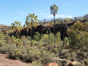
If you are equipped for camping, leave your caravan in Alice Springs and spend two or three days at Palm Valley near Hermannsburg. With approximately twenty kilometres access track with much of it along the Finke River bed; high clearance four wheel drive required. Alice Springs to Hermannsburg 127 kilometres on sealed roads.
A. The Victoria Highway from Katherine to Kununurra spans 514 kilometres. Fuel can be purchased at Victoria River Roadhouse and Timber Creek. Both of these provide serviced caravan park sites.
In addition for self sufficient travellers there are some good Roadside Rest Areas, with and without toilets. The best of these fill in peak season.
There are also National Park campgrounds with a low fee. Those close to the highway and accessible with a caravan are included in the list hereunder.
All are listed as follows:
King West Rest Area 34 kilometres west of Katherine. Barbecues and picnic tables.
Limestone Rest Area 57 kilometres west of Katherine (Vince Connelly Crossing). Barbecues and picnic shelter, tank water, toilet.
Mathison Rest Area 102 kilometres west of Katherine. Barbecues and picnic shelter, tank water, toilet.
Sullivan Campground 177 kilometres west of Katherine in the Gregory (Judbarra) National Park. Barbecues and picnic tables, toilet. NT Parks camping fees apply. Pets permitted in campground on a leash.
Victoria River Roadhouse 194 kilometres west of Katherine, Hotel/Motel and Caravan Park. Fuel.
Timber Creek town 286 kilometres west of Katherine. Caravan Park at the Hotel/Motel. Fuel.
Big Horse Campground 296 kilometres west of Katherine in the Gregory (Judbarra) National Park. Barbecues and picnic tables, tank water, toilet. Boat ramp and fishing. NT Parks camping fees apply. Pets permitted in campground on a leash.
East Baines River Area 343 kilometres west of Katherine. Barbecues and picnic shelter, tank water
Saddle Rest Area 401 kilometres west of Katherine. Barbecues and picnic shelter, tank water, toilet. See photo of Saddle Creek Rest Area.
Keep River National Park (two campgrounds 18 and 32 kilometres from park entrance) with park entrance 46 kilometres east of Kununurra (three kilometres east of the Northern Territory-Western Australia border). May be closed seasonally due to flooding. Barbecues, picnic tables, toilet. Tank water available within the park. NT Parks camping fees apply. No pets. Read about our visit to Keep River National Park.
Update: The 43 kilometre section from Hermannsburg to Namatjira/Larapinta Roads Junction sealing was completed in 2017.
Updated August 2018