Australia So Much to See
A. The longest span without fuel is 377 kilometres from Borroloola to Roper Bar, but this can be by-passed by taking the alternative
easy route via the Carpentaria Highway to the Stuart Highway at Hi-Way Inn Roadhouse. For travellers choosing this alternative,
317 kilometres from Hells Gate Roadhouse in Queensland to Borroloola in the Northern Territory will be the longest distance without
fuel outlets.
The Savannah Way is a tourist route name given to a collection of roads linking Cairns in Queensland with Broome in
Western Australia, covering over 3,600 kilometres. Much of the way follows conventional and mostly sealed roads, with the unsealed
Gulf section from Northern Territory into Queensland being the adventure route, and the most remote. There are alternatives
to some sections, being more or less adventurous. This route can only be travelled during the dry season.
Normanton to Burketown 230 kilometres
From Normanton to Burketown spans 230 kilometres of mainly unsealed roads, with no fuel
outlets along this section.
Leichhardt Falls, 74 kilometres south east of Burketown is a popular camping
site. From here to Burketown the road is mostly sealed.
Burketown to Doomdagee Roadhouse 127 kilometres
This is the start of the unsealed road adventure to Borroloola. You
will encounter dips, and depending on the season, a number of water crossings.
Doomadgee Roadhouse to Hells Gate Roadhouse 81
kilometres
From Burketown to Doomdagee Roadhouse is 127 kilometres, and a further 81 kilometres to Hells Gate Roadhouse.
A loop can be taken incorporating a visit to Boodjamulla (Lawn Hill) National Park. See current closures. Take the Wills
Developmental Road south from the junction 25 kilometres south west of Burketown to Gregory Downs, then west to Lawn Hill. Fuel is sold at Adel’s Grove campground. From here you can return to the Savannah Way at Doomadgee with four-wheel drive recommended. Note that Kingfisher Camp on Bowthorn Station has been permanently closed.
Hells Gate to Borroloola 317 kilometres
From Hells Gate there are no fuel supplies along the Savannah Way for 317 kilometres
until you reach Borroloola. Older maps may show Wollogorang Roadhouse, approximately six kilometres west of the Northern Territory
border, but this roadhouse has been closed for some years.
For those taking the alternative of the Carpentaria Highway from Borroloola to the Stuart Highway, a further alternative route is
to turn south on the Stuart Highway for 36 kilometres to take the Buchanan Highway westwards for 181 kilometres to Top Springs. Then travel 242 kilometres to Timber Creek on the Victoria Highway. Fuel is available at both Top Springs and Timber Creek.
From Kununurra, there is the option to take the Great Northern Highway or the Gibb River Road. Fuel outlets on both these
alternative is shown on The Gibb River Road Fuel and Distances.
These fuel outlets listed here have diesel and ULP, but most
do not have LPG.
Distances have been taken from Google Maps and map books.
October 2016 and updated June 2023
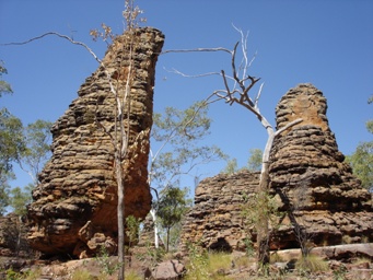
On the Carpentaria Highway option, there are colourful column rock formations and walks in the Caranbirini Conservation Reserve (but
no camping permitted here). From Cape Crawford Heartbreak Hotel and Caravan Park, helicopter flights can be taken over the nearby
Abner Ranges, or to Poppy’s Pool and other features.
Mataranka there the route follows the Stuart Highway, Victoria
Highway and Great Northern Highway to Broome. For these routes see Fuel outlets on the Stuart Highway and Fuel outlets
on the Victoria Highway.
Australia So Much to See is often asked how to manage a camping trip without a fridge. One such person gave me feedback of:
“Just wanted to say thank you for such a great informative website. Am doing a trip to the Kimberley in two weeks and this has given me so much information around food without a fridge/cooler. Great to finally find something that actually gives practical ideas. Yours is the one site that I am totally comfortable in sharing as valuable information and will keep in marked for future reference and recommendation to others.”
Foods you can choose and what meals you can easily make are shown here http://www.australiasomuchtosee.com/cooking.htm together with tips on how to keep your food fresh.
Australians enjoyed camping holidays for many decades without refrigeration. Our early explorers crossed this land on foot or by camel, well before refrigeration.
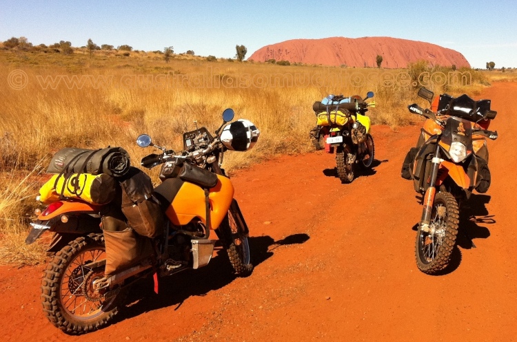
These days some travellers want to tour into less accessible places and camp out while away from their caravan, and some travel light by motor cycle. This can be done without the need to take a fridge, while still eating well.
You can also read about the choices of fridge types to suit your needs in your caravan or motorhome at http://www.australiasomuchtosee.com/starting2.htm#whichfridge
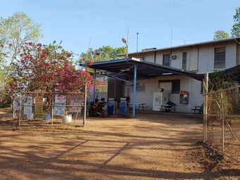
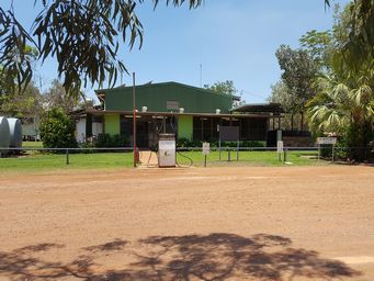
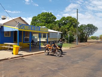
Cairns to Normanton 680 kilometres, with frequent fuel outlets
From Cairns to Normanton, you will be following the Bruce Highway
to Gordonvale, the Gillies Road climbing the range to the Atherton Tablelands, then joining the Kennedy Highway for 128 kilometres
to take the Gulf Developmental Road west to Normanton. There is no shortage of fuel outlets along this 680 kilometre sealed
road route.
Places of interest include the Atherton Tablelands scenery, lakes and waterfalls. Campgrounds
at Lake Tinaroo, volcanic lakes such as Lake Barrine, and lovely waterfalls such as Millaa Millaa falls. Visit Innot Hots Springs
and Undara Lava Tubes. Stop at the historical gold mining town of Croydon, once the fourth largest town in Queensland. Take a train trip between Croydon and Normanton on the historic Gulflander.
There is an optional longer route incorporating mainly unsealed roads leaving Cairns via Kuranda to Mareeba, Chiilagoe, and taking the Burke Developmental Road to and following the Mitchell River before turning south towards Kurumba and to Normanton. This is a journey of 766 kilometres, with no fuel outlets between Chillagoe and Normanton, a distance of 560 kilometres. See details and photos of this route on Cape York Australia - Burke Developmental Road.
From Borroloola, travellers can continue north along the Savannah Way joining the Nathan River Road through the Limmen National Park to# Roper Bar covering 377 kilometres. Note no fuel at # Roper Bar may be difficult to access with a trailer attached. It is a further 174 kilometres to the Stuart Highway, and three kilometres on to Mataranka.
Lorella Springs has closed
to tourists 2023. For those visiting Lorella Springs Wilderness Park, fuel is available there, currently $3 per litre. Travel 135 kilometre north west from Borroloola along the Savannah Way then take the Lorella Springs access road for 29 kilometres.
Places
of interest include the side trip to Lorella Springs Wilderness Park the Limmen National Park the Southern and Western Lost Cities
(column rock formations), Butterfly Falls, Saint Vidgeon’s Ruins and Lomarium Billabong.
We found the fuel outlet on the southern side of the town in Borroloola was priced much more expensive than the one to the north,
both are along the main street through the town (2009).
Option 1: Borroloola to # Roper Bar 377 kilometres however fuel can be obtained at Lorella Springs,
reducing the distance without fuel to Roper Bar to 275 kilometres.
Roper Bar to Mataranka 177 kilometres. See update # re no fuel at Roper Bar
Option 2: Borroloola to Cape
Crawford Roadhouse 105 kilometres
Cape Crawford to Hi-Way
Inn Roadhouse 278 kilometres
or 383 kilometres if not refuelling atCape Crawford Roadhouse
Hi-Way Inn Roadhouse to Mataranka 168 kilometres
Off the track options for camping or fuel
Seven Emu Station is accessed from the Manangoora Road which heads north from the
Wollogorang Road (Savannah Way) just east of the Foelsche River crossing approximately 100 kilometres south east of Borroloola, then
take the Seven Emu Road, crossing the Robinson River (dry season) to the station. This is approximately 27 kilometres from the
Wollogorang Road. There is camping along the Robison River seven kilometres from the homestead at $50 per car. Pit toilets,
water and firewood provided at the Cliffs campsite. Other unserviced sites may be available. Birdwatching, boating and fishing.
This cattle station has been owned and operated by an Aboriginal family, since being purchased in 1953. Wildlife, cultural and bush
tucker tours. Fuel may be available but phone 08 8975 9904 to check.
Manangoora Station Campground also provide
remote bush camping for 4WD. They approximately thirty kilometres north of the Wollogorang Road via the Manangoora Road. Fishing
and boat launching on the Wearyan River. Phone: 08 8975 9549
Robinson River Community is a closed Aboriginal community
50 kilometres south of the Savannah Way via the Robinson River Access Road, approximately 100 kilometres south east of Borroloola,
with fuel and supplies but phone 08 8975 9791 to check. Permit required from the Northern Lands Council.
# Update July 2018 No fuel at Roper Bar - this has permanently closed. Fuel is available at Ngukurr, which will add 66
kilometres round trip if you choose to go here for fuel. From junction Roper Highway and Nathan River Road,
follow the Roper Highway across the Roper River and head east for 31 kilometres, turning off south the Ngukurr townsite for a further
two kilometres. Ngukurr is a community with approximately 900 people. Fuel is available at the Ngukurr General Store.
Phone (08) 8975 4626 to check times and availability.
